Upload Scans To Plan Routes – Import Addresses From Photos And PDF Scans
With Route4Me’s Upload Scan(s), you can plan and optimize routes from photos, screenshots, and PDF scans of your stop lists. Route4Me’s AI reads paper manifests, printed sheets, screenshots from other systems, emails, chat messages, and even handwritten notes, then converts them into route destinations. You can review every recognized stop before it’s imported, so you stay in control of what’s added to your route. This guide explains how to upload files and ensure you get the best results.
Table of Contents
Quick Steps To Plan Routes From Scans On Route4Me’s Web Platform
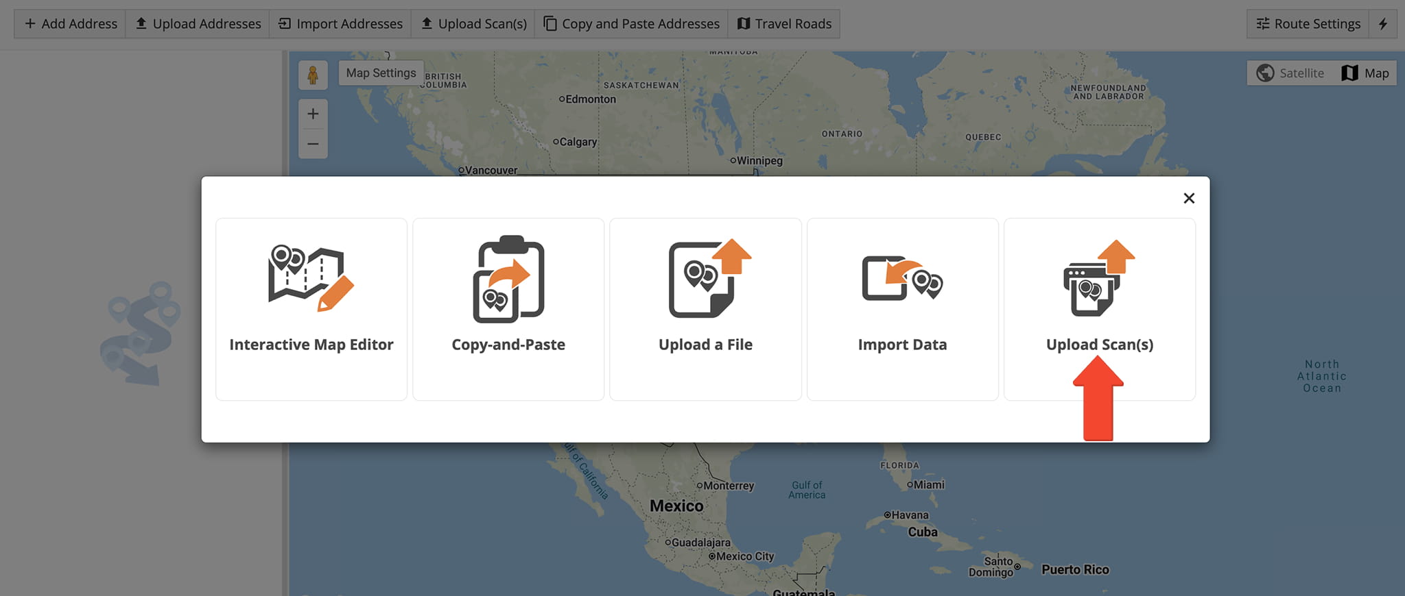
- Go to “Dynamic Routing” > “Plan New Route” and click “Upload Scan(s)” in the toolbar.
- Select an Optimization Profile (or click “Skip“), adjust Route Settings, and click “Save“.
- Drag and drop or select up to 20 files, wait for recognition to finish, and click “Continue“.
- Review the “Data Mapping” and “Verify Addresses on Map” screens, then click “Finish Import” to plan your route.
NOTE: Learn about additional ways to import addresses and plan routes.
Upload Scan Requirements – Supported Files, Limits, And Layouts
Upload Scan(s) accepts images and PDFs of stop lists. However, files that don’t meet the requirements detailed in the table below are rejected.
File Upload Requirements
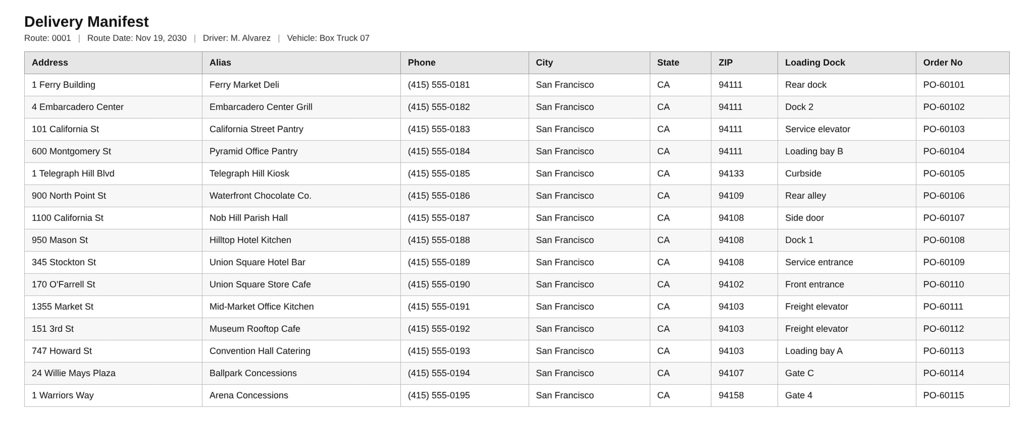
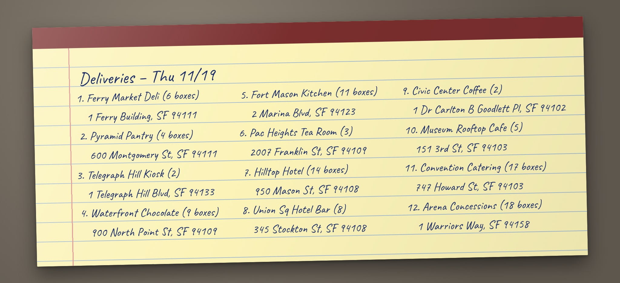
Upload Scan(s) recognizes stop lists in a wide range of formats, from printed tables to handwritten notes. See the table below for an overview of a accepted formats.
Supported Layouts
Upload Scans And Plan Routes – AI Address Recognition For Scanned Documents
Upload Scan Files – Add Scanned Destinations To A New Route
To upload a scan file, go to “Dynamic Routing” > “Plan New Route” from the Navigation Menu and click “Upload Scan(s)” in the toolbar.
Select an Optimization Profile or click “Skip“. Adjust your Route Settings and click “Save“. If you select “Use Depot From File“, Route4Me uses the first address or the row marked as Depot.
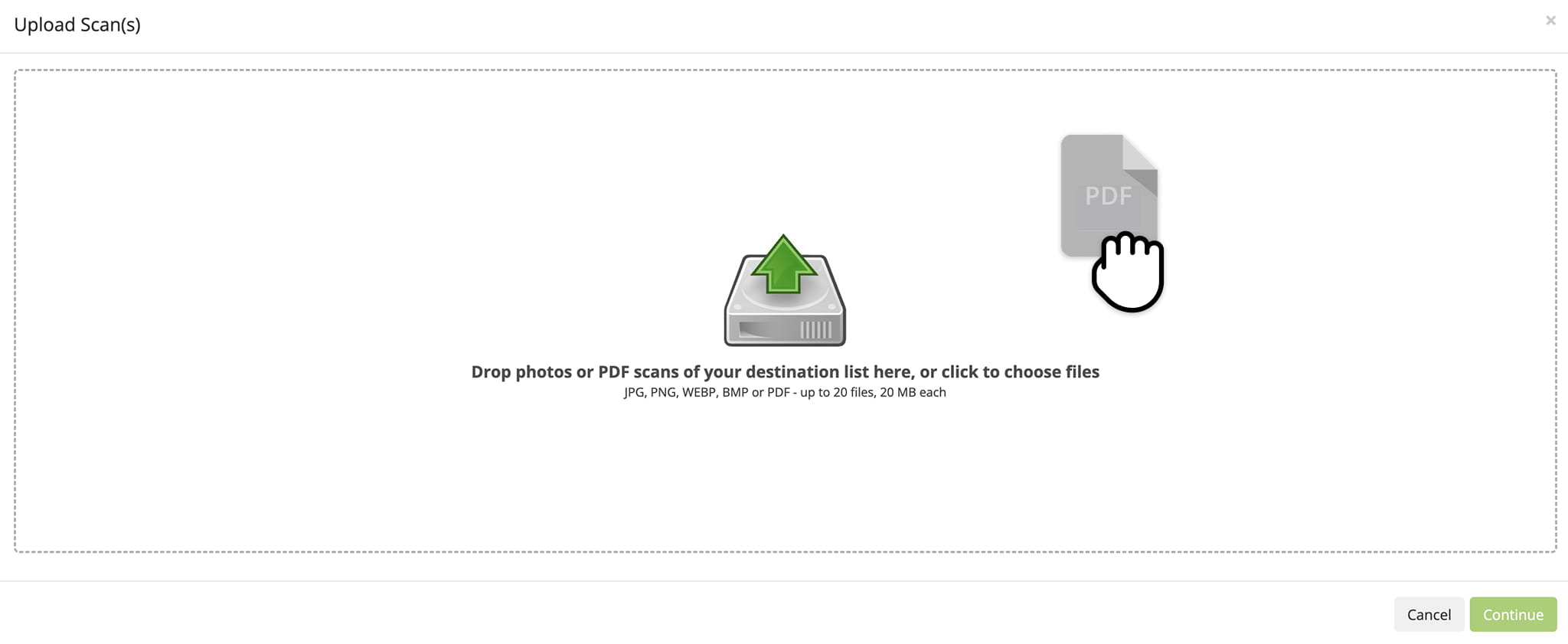
In the Upload Scan(s) window, drag and drop your scan file or select up to 20 files.
Review Mapped Columns – Assign Route4Me And Custom Fields
On the “Importing Addresses into Route” screen, Upload Scan(s) automatically matches each column on your document to the corresponding Route4Me field. The table below shows which fields are recognized.
Columns that don’t match a Route4Me field appear as “Custom” columns, so none of your information is lost.
If a column is matched to the wrong field, or should go into a Route4Me field instead of a custom one, click the Down Arrow button above the column to select the correct field.
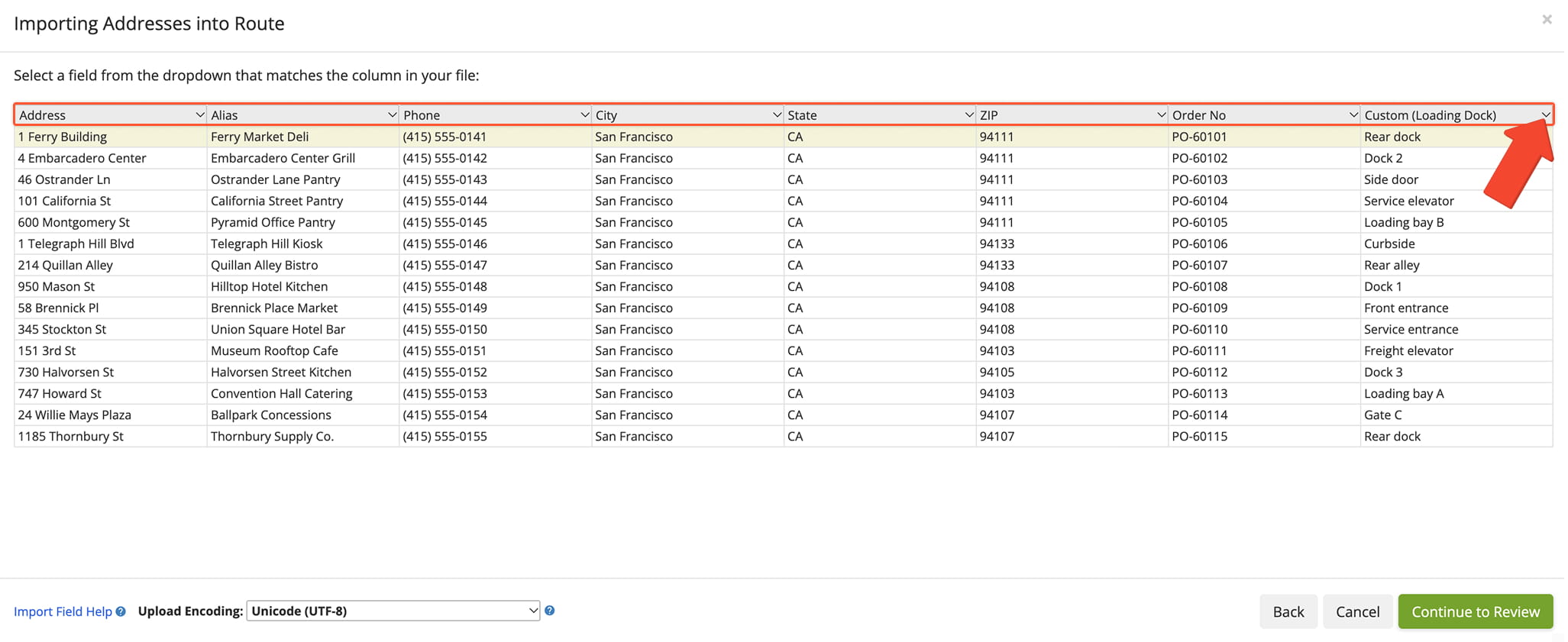
Recognized Fields
Verify Recognized Addresses – Found, Verify, And Review Tabs
Once your addresses are geocoded – matched to an exact location on the map – the “Verify Addresses on Map” screen sorts your stops by how confidently they were recognized and located.
Addresses found with high confidence are ready to import. Stops with flagged values or low-confidence locations are grouped separately so you can check them before importing.
Route4Me checks every value and never guesses. If a value can’t be confirmed, it is flagged and shown on the “Verify” or “Review” tab. The table below details reasons why a value is flagged.
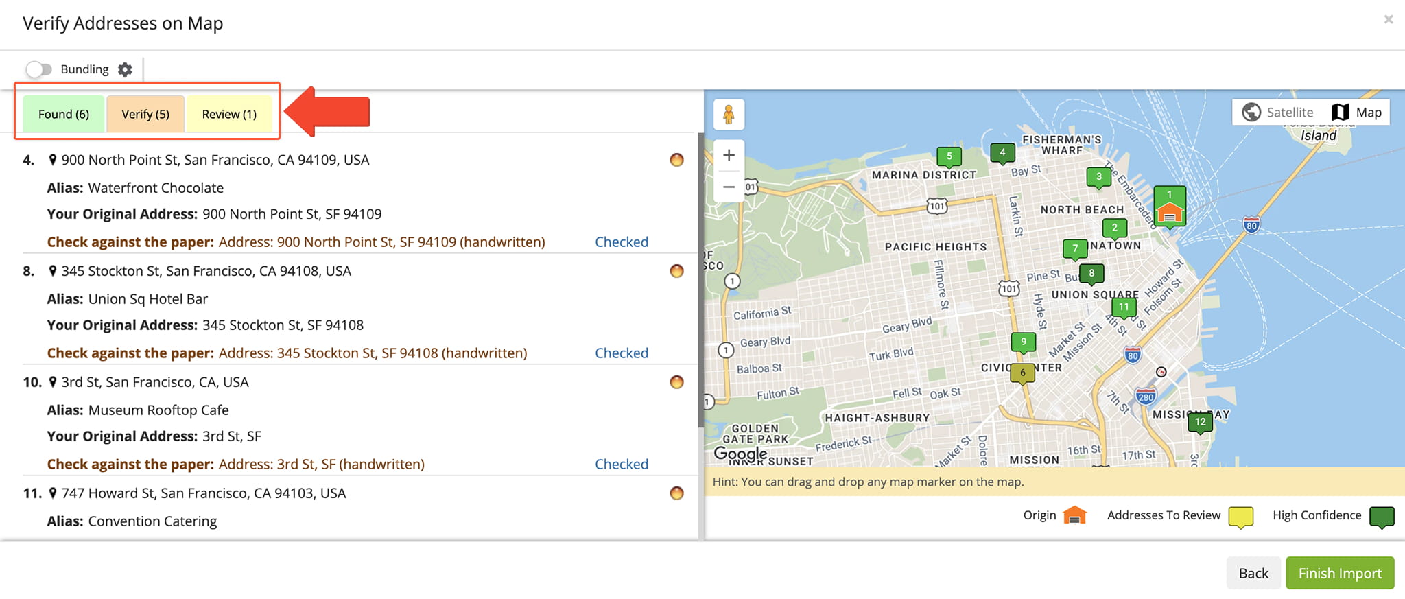
Review Flags
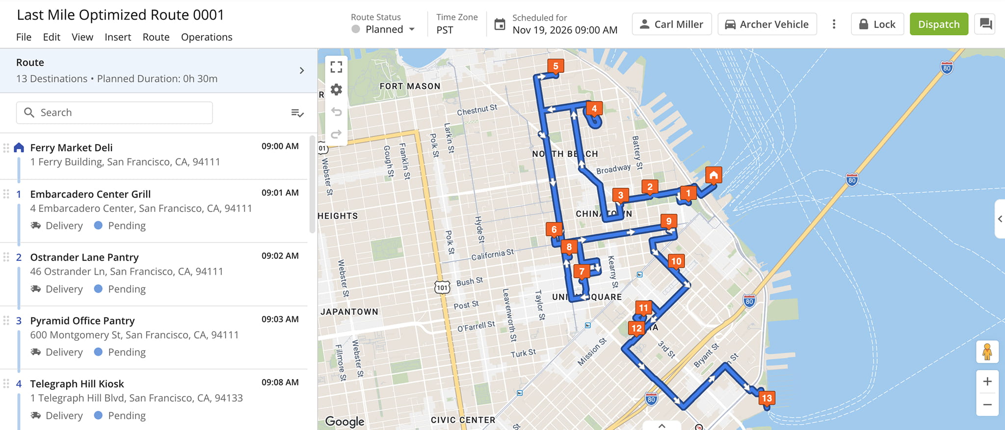
Import Recognized Stop – View Planned Routes
Click “Finish Import” to add the stops to your route. Route4Me plans and optimizes the route based on your Route Settings. You can then manage the route from the Route Editor or Routes Page.
Upload Scan Tips – Formatting Your Documents For Best Results
Most documents upload without any changes. If a stop list doesn’t import as expected, use the tips below to adjust its format:
Upload Scan Tips
Transposed Tables
Tables with one column per stop aren't supported.
Use a standard table with one row per stop.
Coordinates
Combined lat, lng values in one cell and DMS format aren't converted.
Use decimal degrees in two separate columns.
Abbreviated Headers
Abbreviations such as ST, PO #, Inv #, or Svc Min appear as custom columns.
Remap them on Data Mapping.
Dates And Times
Route Date and Route Start Time are imported as printed.
Check the format on Data Mapping.
Handwriting
Struck-through lines are imported as stops.
Remove them on the Verify tab.
Visit Route4Me's Marketplace to Check out Associated Modules:
- Route Optimization
Stops Bundling
- Route Optimization
Mixed Vehicles Routing
- Route Optimization
Max Weight per Route
- Route Optimization
Max Stops Per Route
About author: Daniel Archer