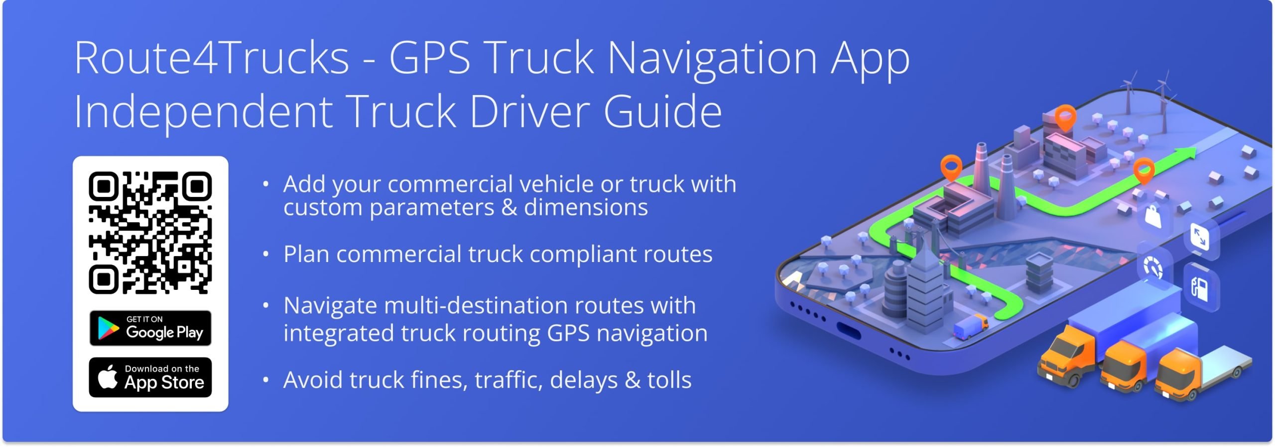
Route4Trucks For Independent Drivers – GPS Truck Navigation App For Commercial Vehicles
Route4Trucks the best GPS truck navigation app and multi-destination truck route planner for commercial vehicle drivers. As an independent trucker, you can use Route4Trucks to plan and navigate multi-stop truck routes with road restrictions and commercial constraints, comply with commercial regulations, and avoid fines, tickets, and toll fees. Our voice-guided GPS navigation on commercial routes helps you navigate safely and keep your eyes on the road.
See Route4Trucks For Company Drivers
Table of Contents
Route4Trucks Quick Video Guide For Commercial Truck Drivers
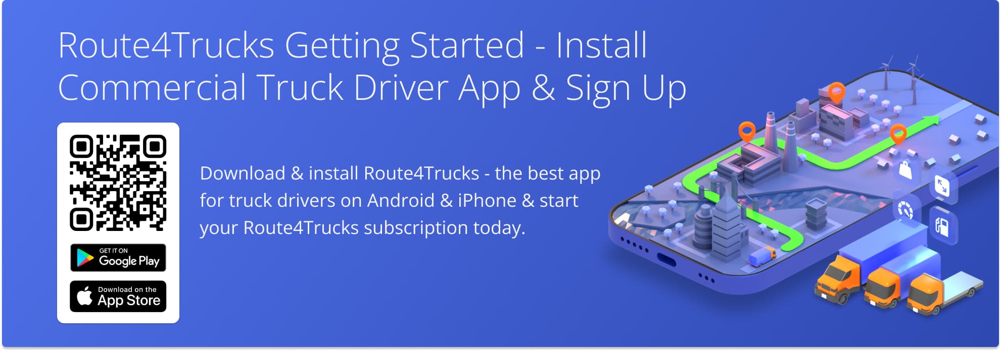
Getting Started With Route4Trucks On Android, iPhone And iPad
Route4Trucks is supported on iOS and Android. You can easily download and install the app on your iPhone, iPad, or Android device. Route4Trucks provides identical functionality across both iOS and Android GPS apps for independent truckers. To install Route4Trucks on your device, scan the QR code in the image below.
Learn more about installing Route4Trucks on Android and installing Route4Trucks on iPhone.
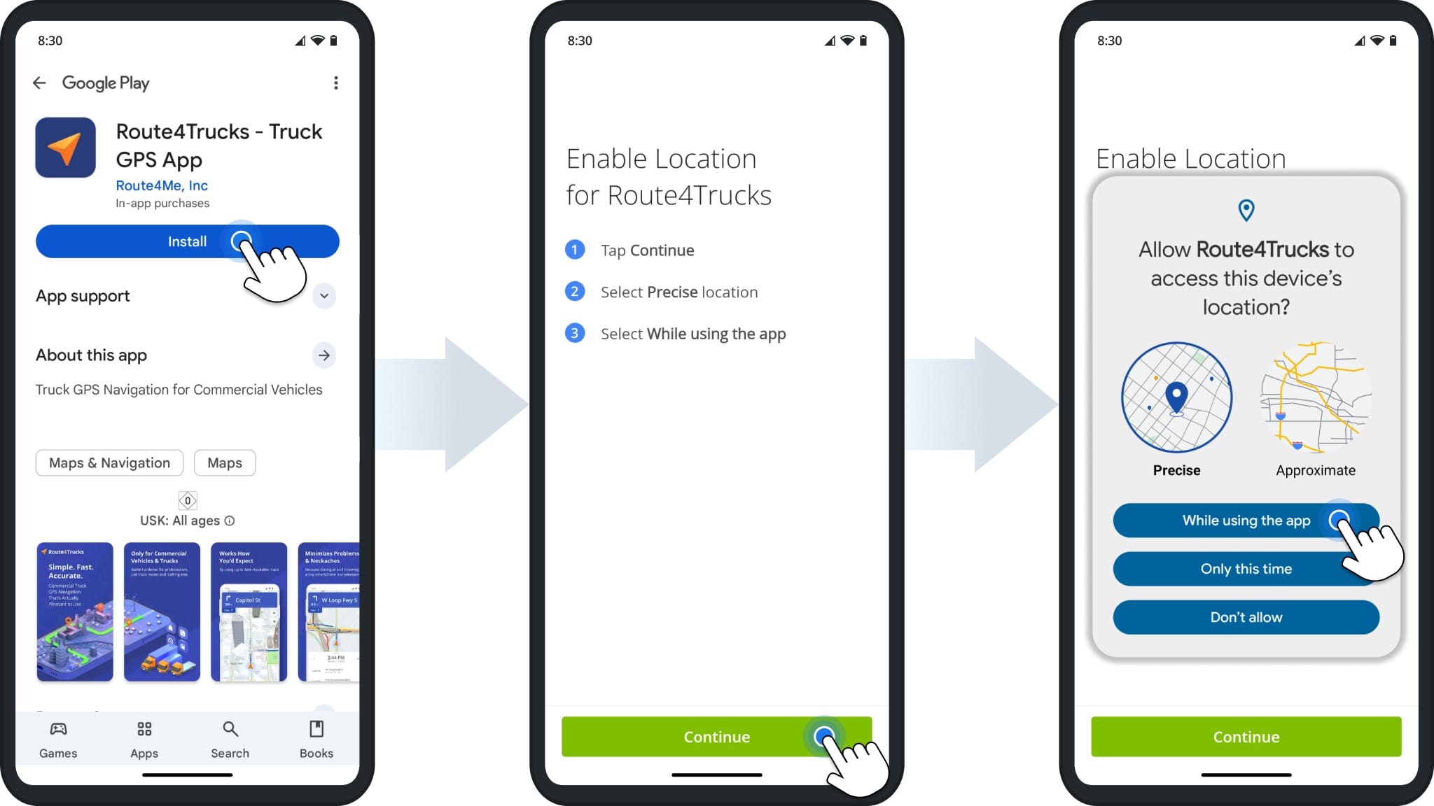
Download And Install Route4Trucks On Android From Google Play Store
You can download the best Android truck routing app quickly and easily. Go to the Play Store, search for “Route4Trucks“, and tap “Install“. Then, enable location permissions to allow GPS navigation. You can use Google SSO to sign in with your Google account or tap “Skip” to try the app without signing in.
Download Route4Trucks Android App
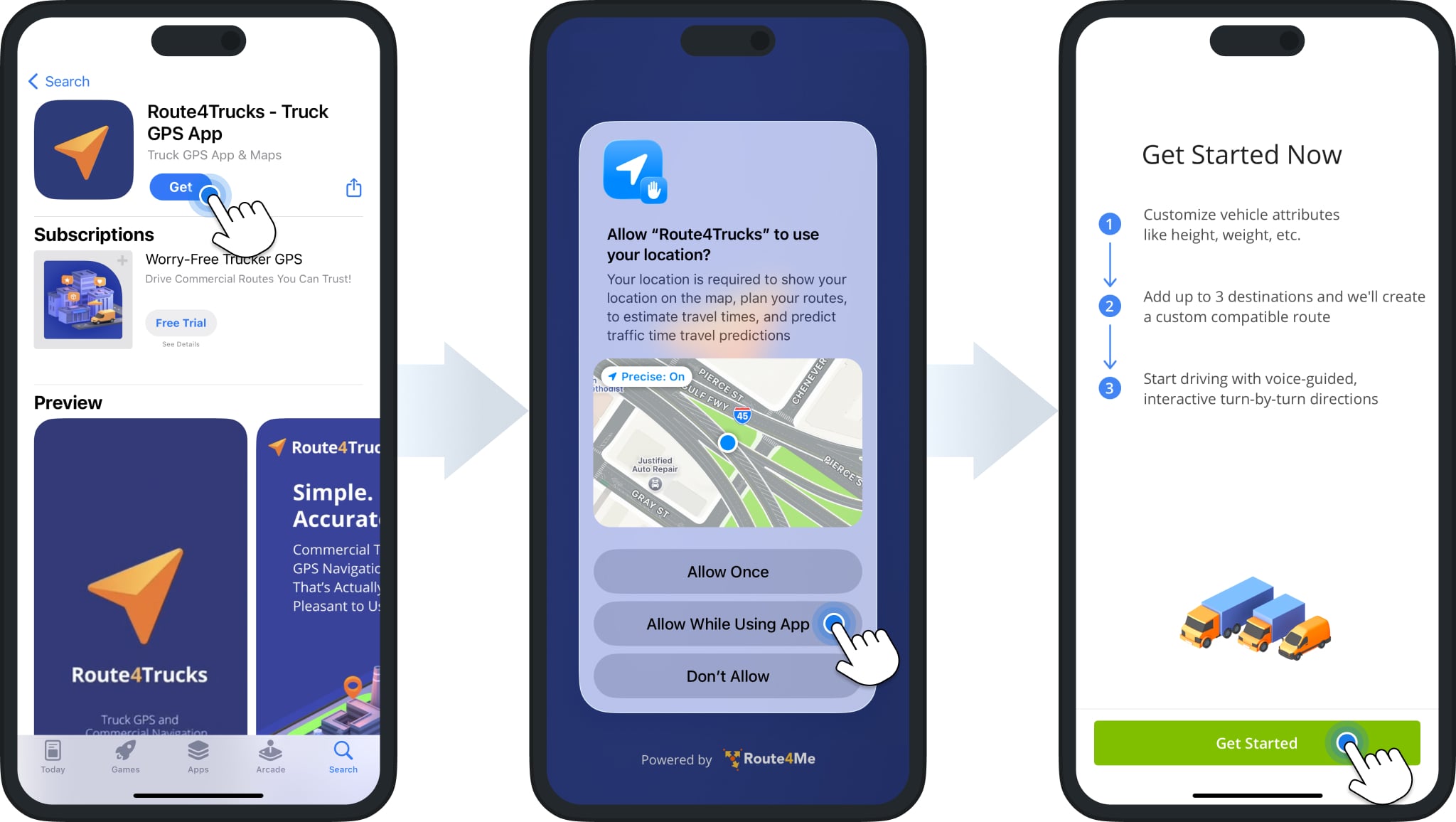
Download And Install Route4Trucks On iPhone Or iPad From Apple App Store
The best iPhone app for truckers is available to download for free directly from the App Store. To do so, open the App Store on your device, search for “Route4Trucks“, and tap the “Get” button. Then, enable location permissions for the app to allow GPS navigation. You can use Google SSO to sign in with your Google account, Apple SSO to sign in with your Apple account, or tap “Skip” to try the app without signing in.
Download Route4Trucks iPhone & iPad App
How To Add Commercial Vehicle Details To Your Trucker App
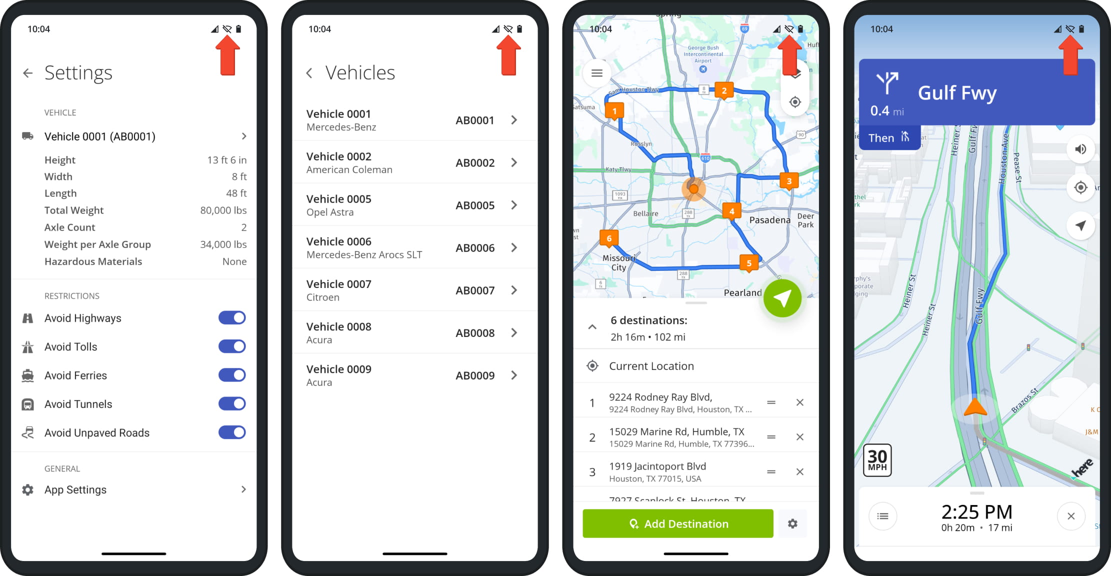
Adding and managing trucks with Route4Trucks is quick and easy. When you install Route4Trucks, the app prompts you to add a commercial vehicle, which is necessary to provide accurate truck directions that comply with applicable regulations.
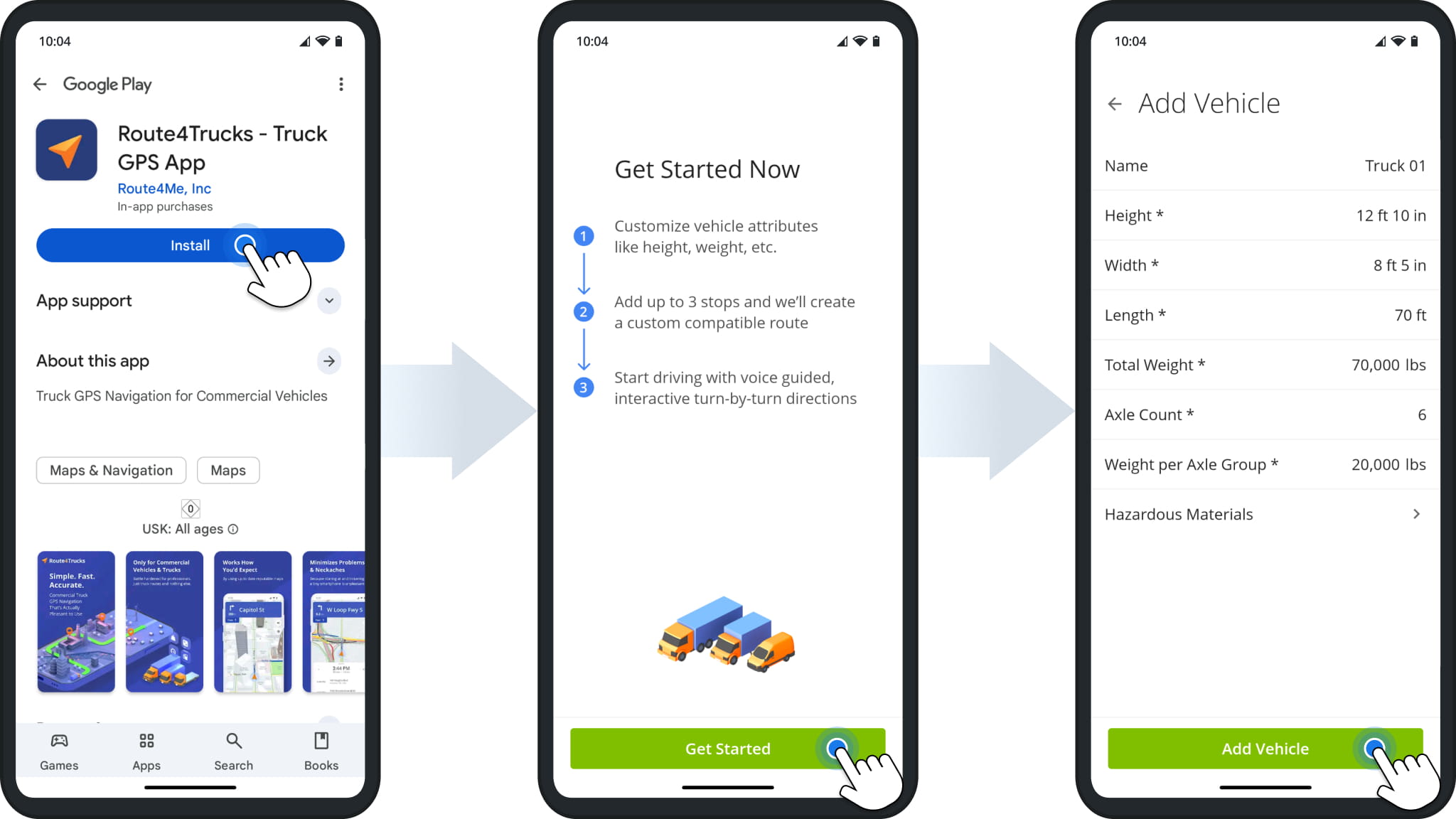
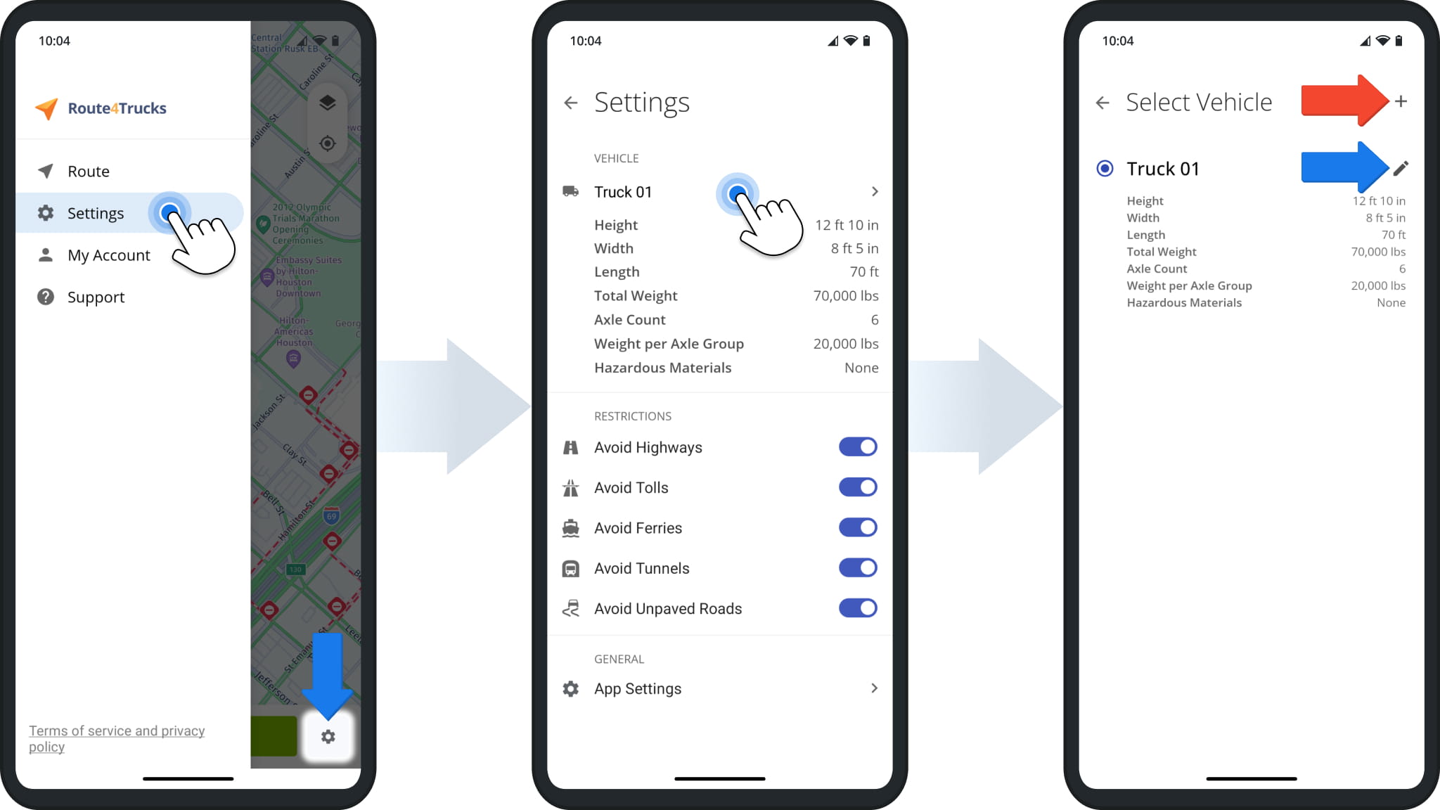
You can then edit that vehicle and add more trucks after you sign up for an account. Simply open the trucker app settings from the main menu, tap the active vehicle, and then you can add another vehicle or edit the selected truck’s details.
How To Plan Multi-Destination Commercial Vehicle Truck Routes
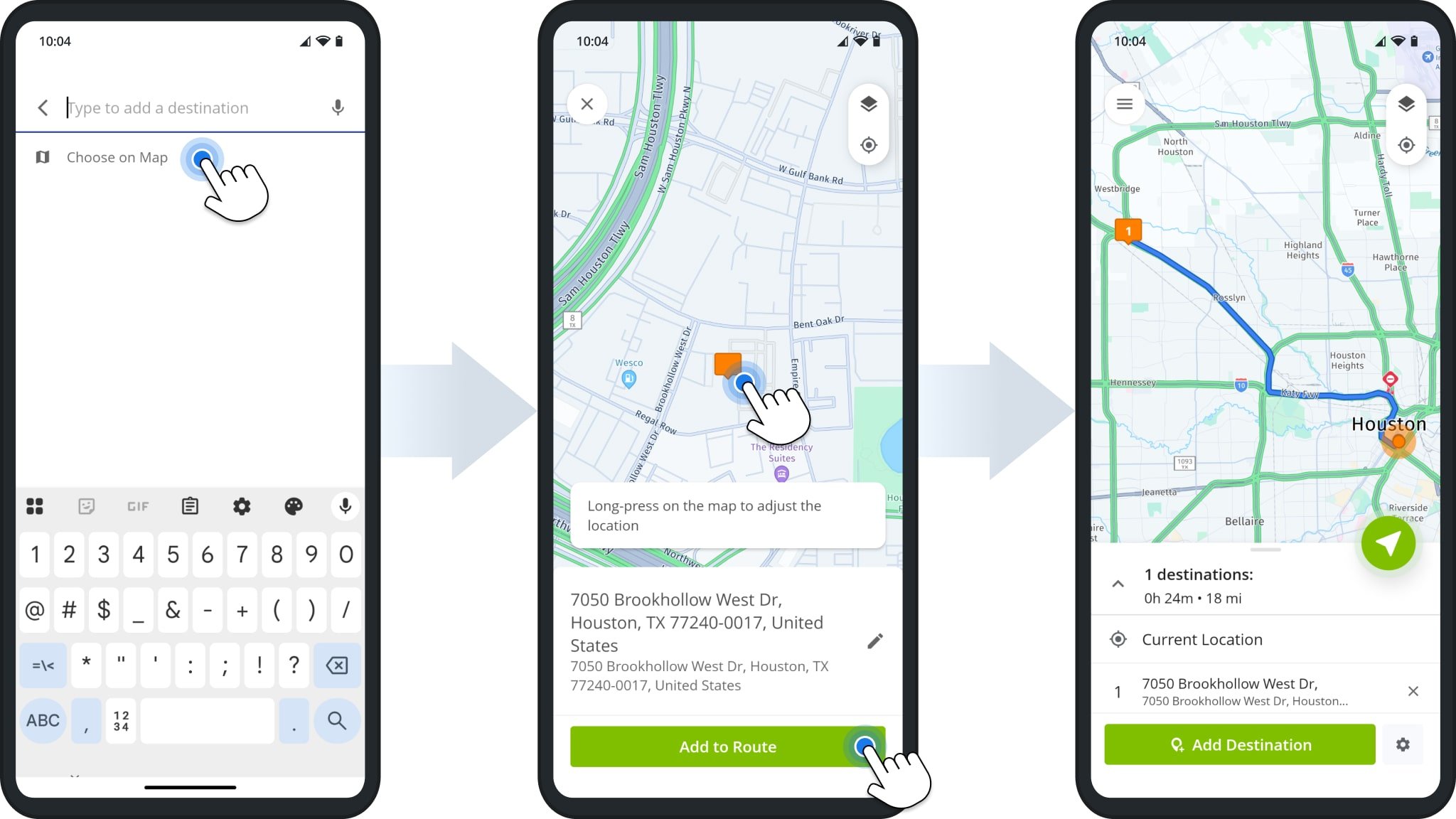
To plan truck routes, all you need to do is add destinations. Route4Trucks will automatically suggest valid addresses based on the entered details. You can also pick addresses directly on the map. After that, Route4Trucks will automatically provide the fastest and most optimal truck driving directions to your destinations. Learn more about Trucker App Route Planning.
Navigate Multi-Stop Commercial Route With Truck GPS Voice Navigation
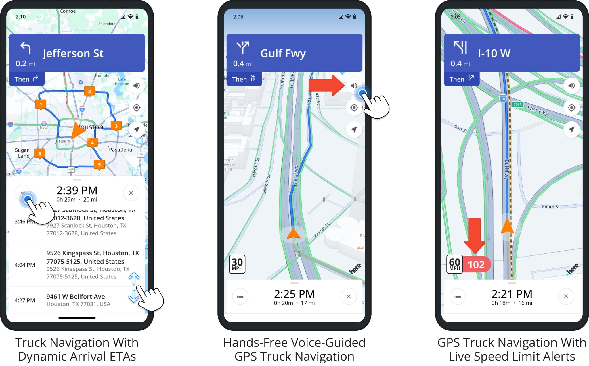
Route4Trucks automatically generates the fastest and most optimal truck driving directions based on the parameters and truck restrictions of the selected vehicle.
Built-in GPS navigation with real-time voice-guided truck directions, speed limit alerts, live traffic and road conditions, and more enables truck drivers to complete routes safely and in less time. Learn more about Route4Trucks Commercial Route Navigation.
Route4Trucks App Settings, Vehicle Management And Road Restrictions
You can adjust your Route4Trucks preferences for distance units, live traffic overlays, voice-guided GPS truck navigation, and more. Learn more about Route4Trucks App Settings.
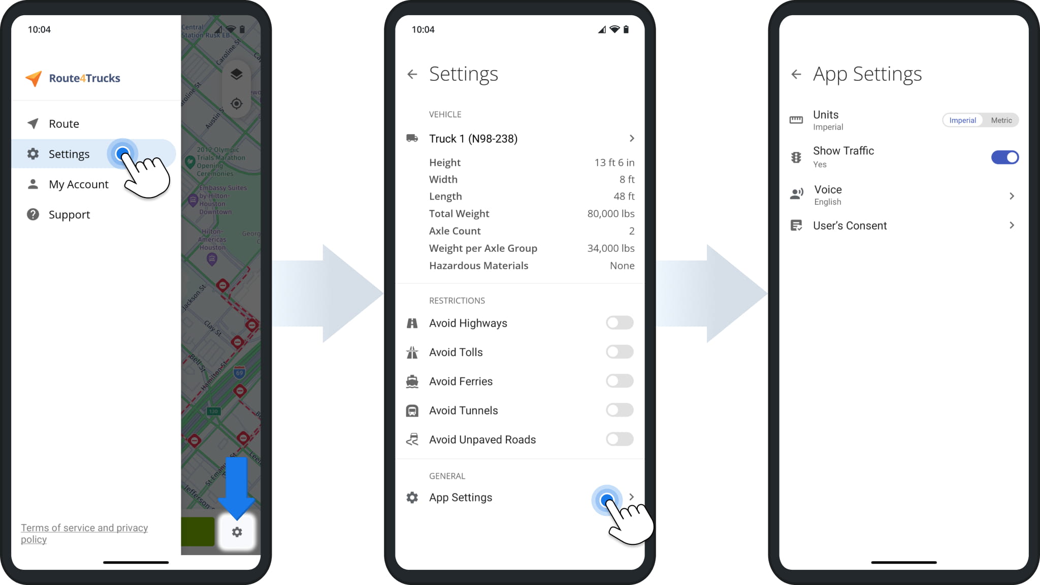
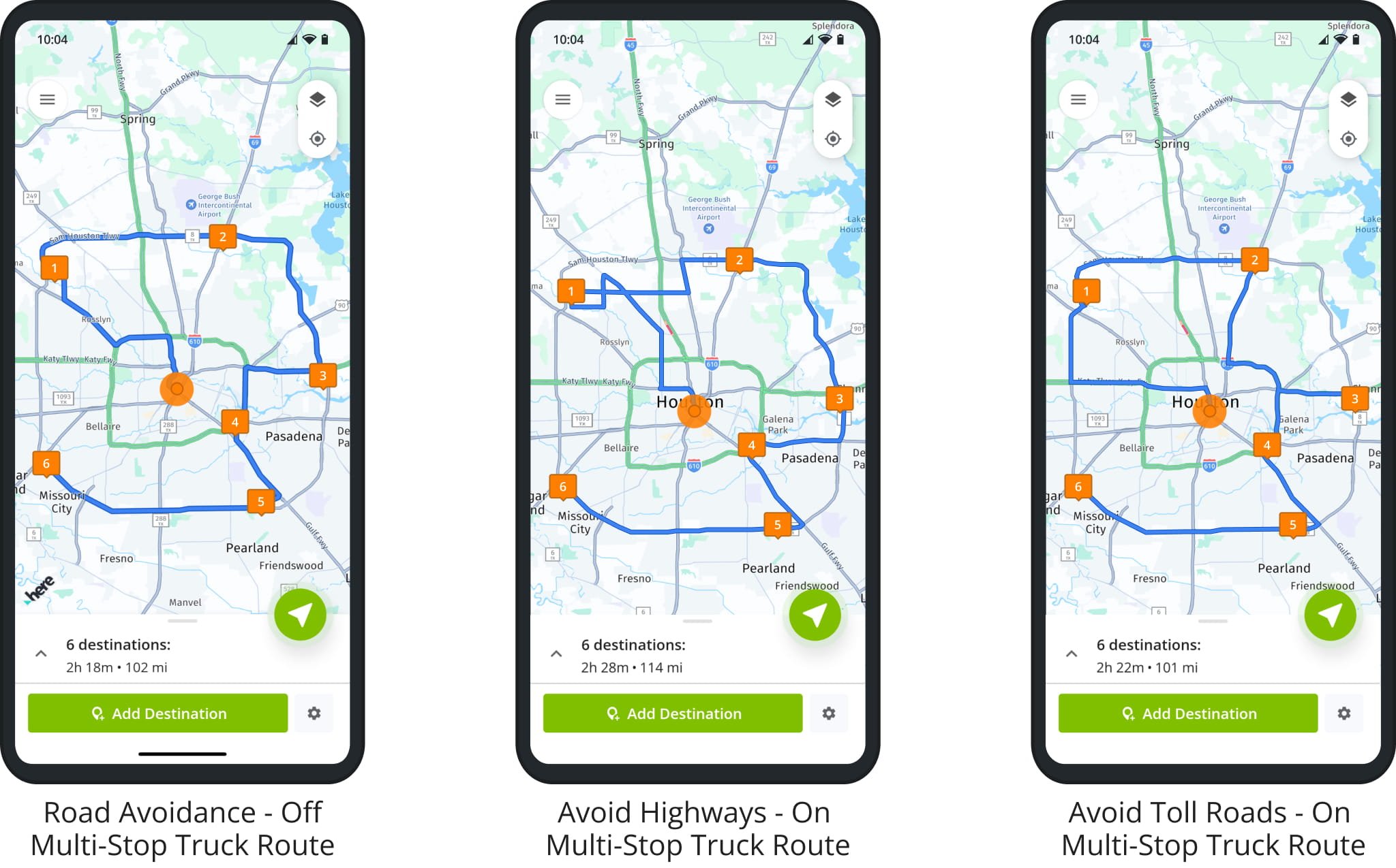
You can also use truck road restriction and avoidance settings to plan and navigate truck routes to avoid tolls, unmarked roads, highways, ferries, tunnels, etc. Accordingly, your truck route and trucker GPS navigation directions can vary depending on the enabled and disabled road avoidance settings.
Offline Mode – Access Vehicles, Navigate Routes And More Without Internet
You can even use Route4Trucks without internet, such as when traveling in rural areas, experiencing connection issues, no coverage, etc. As long as you’ve signed in to your account and opened the app while connected, Route4Trucks retains its most important functions. Learn more about Route4Trucks Offline Mode.
Route4Trucks App Account Settings And Subscription Management
Your Route4Trucks account is linked to the Apple or Google account used for registration. Accordingly, you can only sign in to Route4Trucks using your Google or Apple account, and Route4Me doesn’t store or manage your account password. Learn more about Route4Trucks Subscription Management.
NOTE: Route4Trucks is a standalone app. Route4Trucks and Route4Me accounts and subscriptions are managed separately.
Route4Trucks iOS And Android App Software And Hardware Requirements
To make sure you can easily navigate commercial vehicle-compliant routes, Route4Trucks is supported on most Apple devices (iPhones and iPads) and most Android devices. Learn more Route4Trucks Software and Hardware Requirements.
Visit Route4Me's Marketplace to Check Out More Add-Ons and Modules:
- Route Optimization
Commercial Vehicle & Truck Routing
About author: Kristian Andreev
Kristian is a Technical Writer at Route4Me. With over a decade of experience in writing and localization, he's an expert at communicating complex technical data in a clear, concise, and user-friendly way. Passionate about bridging the gap between engineers and users, he specializes in creating documentation to streamline onboarding, enhance product usability, and support global teams on the path to success.