Incident Snapshots – In-Depth Incident Reports With Maps, Linked Records & Dashcam Footage
Incident Snapshots are in-depth incident reports for individual safety events in the Incident Center. Each Incident Snapshot shows the Incident’s event data and all system records and entities linked to it, all on a single page with an interactive map. You can also watch driver-facing and road-facing dashcam footage to verify what happened and keep your fleet compliant.
Table of Contents
Open Incident Snapshots – Access Incident Reports From The Incident Center
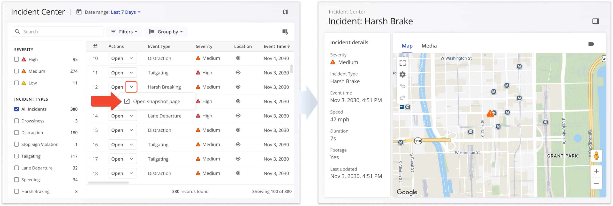
To open an Incident Snapshot, go to the Incident Center, click the arrow next to “Open” on any Incident, and select “Open snapshot page”. The Incident Snapshot title shows the Incident Type, for example “Incident: Harsh Brake”.
Incident Snapshot Overview – In-Depth Safety Incident Reports
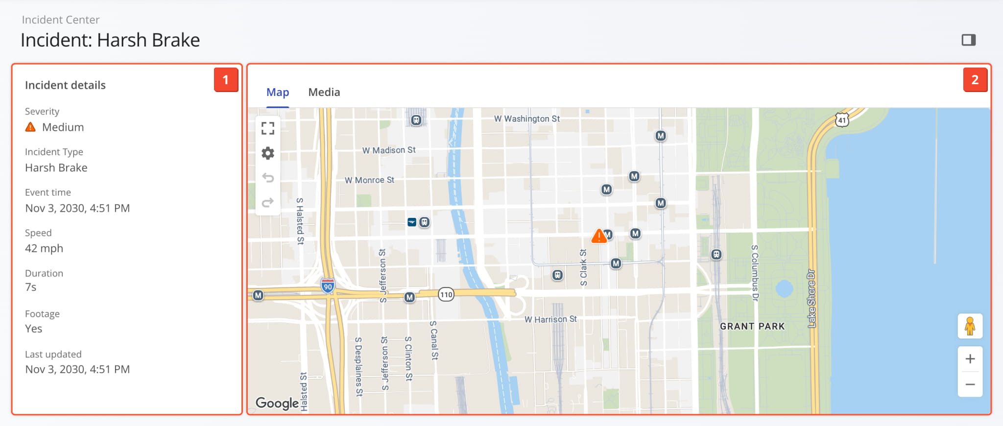
An Incident Snapshot is a dedicated report page for a single Incident. Incident data syncs to your account automatically from your Telematics Connections, so every Incident in the Incident Center has its own snapshot. Incident Snapshots have two sections:
- Incident Summary: The panel on the left shows the Incident’s event data, location, and linked records.
- Incident Map & Media: The primary section shows where the Incident occurred and any recorded dashcam footage.
Incident Snapshot Summary – Event Data, Location & Linked Records
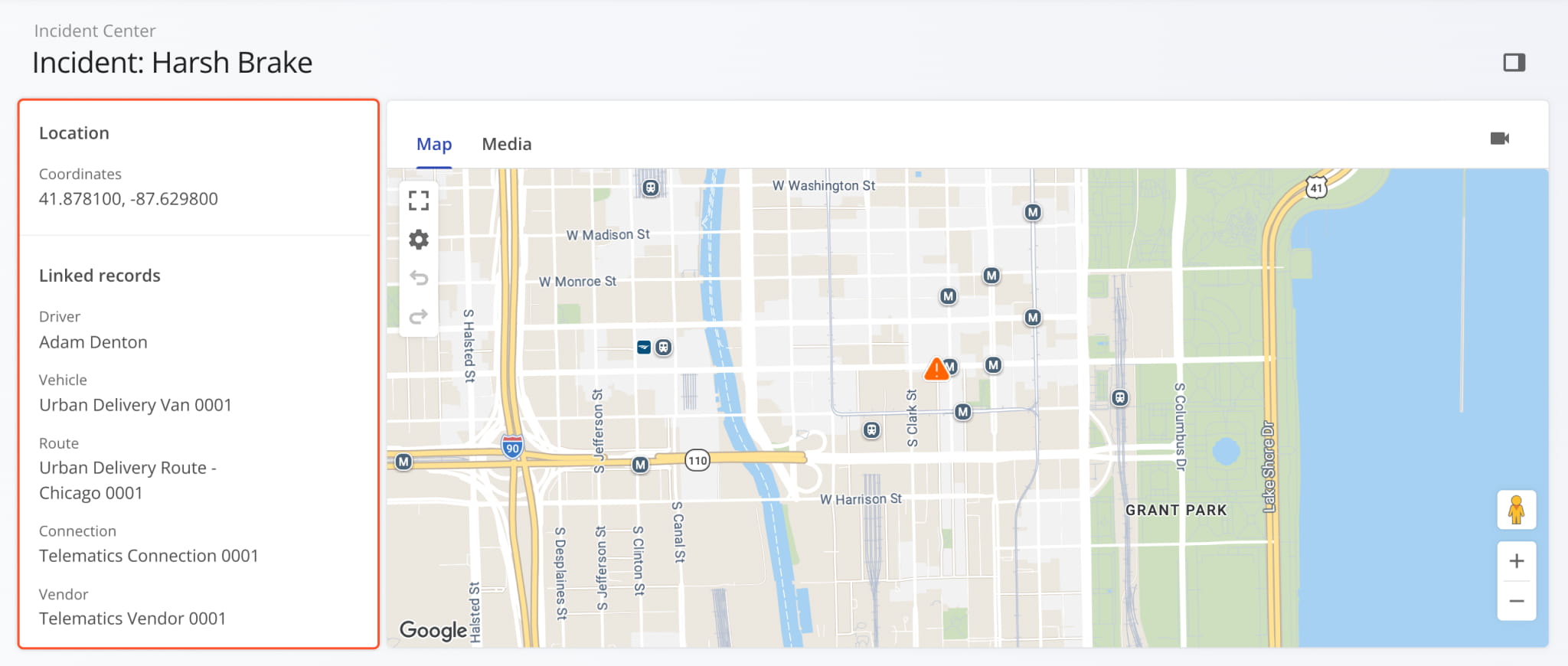
The Incident summary panel on the left of an Incident Snapshot shows the Incident’s key details. Scroll down in the panel to see the Incident’s Coordinates and its “Linked records”. You can click any linked record, such as “Driver” or “Vehicle“, to open its respective snapshot. See the table below for more information about each Incident data field.
Incident Snapshot - Detail Summary Fields
Incident Snapshot Map – Incident Locations, Map Layers & Route Metrics
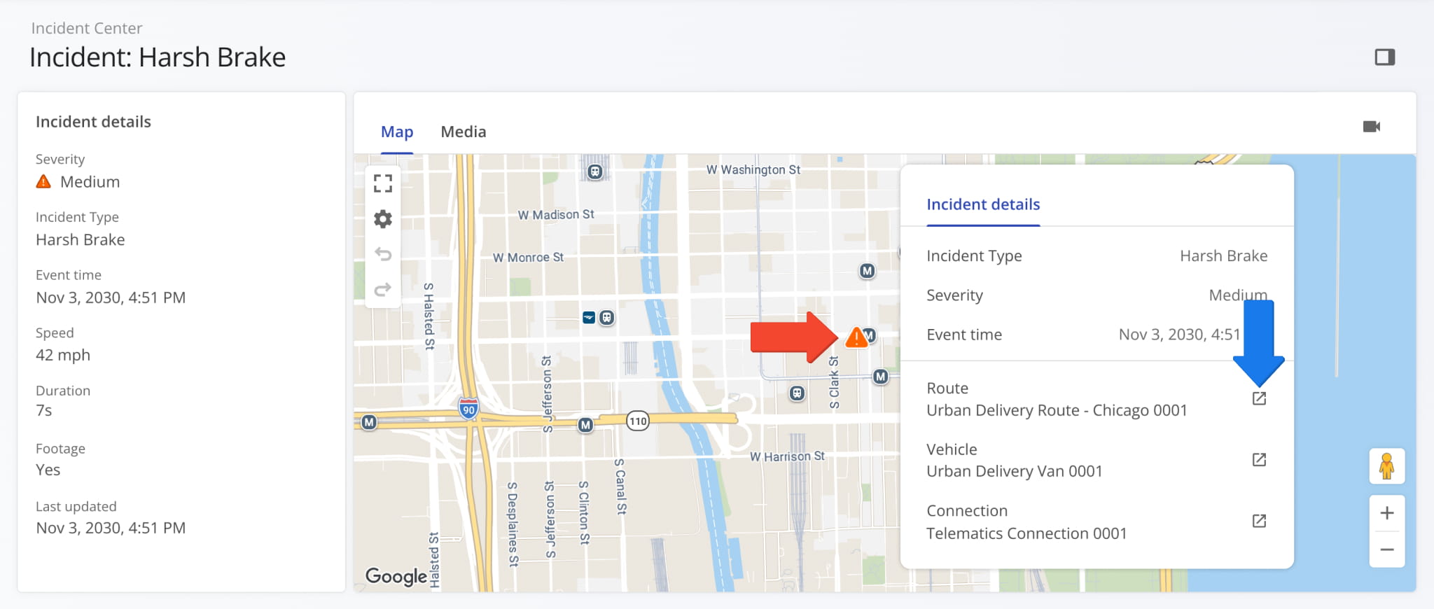
The “Map” tab on the on the right of an Incident Snapshot shows exactly where the Incident occurred. The Incident’s map marker is color-coded by severity: Red = “High”, Orange = “Medium”, Yellow = “Low”.
Incident Map Marker – Preview Incident Details & Linked Records
Hover over an Incident’s map marker to see a pop-up with its key details. The “Incident details” pop-up shows the Incident Type, Severity, and Event Time, and linked records such as the Incident’s associated Route, Vehicle, and Telematics Connection.
Click the Link Icon next to a linked record to open its Route Snapshot, Vehicle Snapshot, or Connection Snapshot.
Map Layers & Route Metrics – See Incidents In Route Context
To enable additional information in Incident Snapshots, you can use:
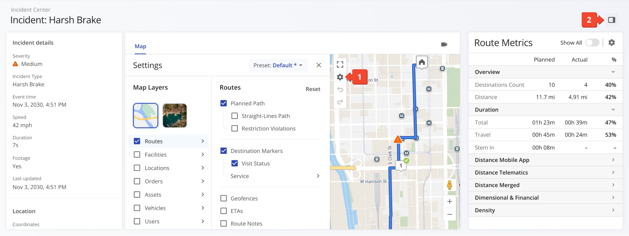
- Map Layers & Settings: Click the Gear Icon on the map to open the “Settings” panel, where you can switch map views and enable Map Layers. For example, enable the “Routes” layer to show the planned path of the Route where the Incident occurred.
NOTE: Learn more about Map Layers & Settings. - Route Metrics: Click the Side Panel Icon in the upper-right corner of the Incident Snapshot. The “Route Metrics” panel shows planned and actual values for the route associated with the incident.
NOTE: Learn more about Route Performance Metrics.
Incident Dashcam Footage – Watch Driver-Facing & Road-Facing Videos
If an Incident has recorded footage, you can:
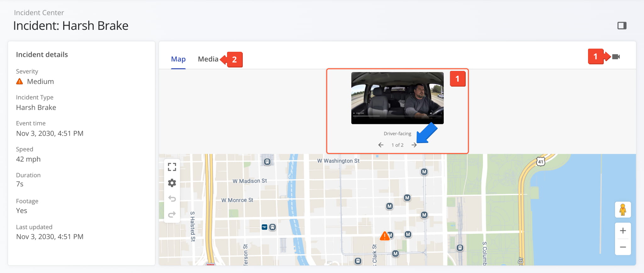
- Preview: Click the Camera Icon in the upper-right corner of the “Map” tab to preview footage without leaving the map.
You can use the arrows under the video to switch between the available camera feeds. - Open Media: To see all available recordings in their own video players, go to the “Media” tab.
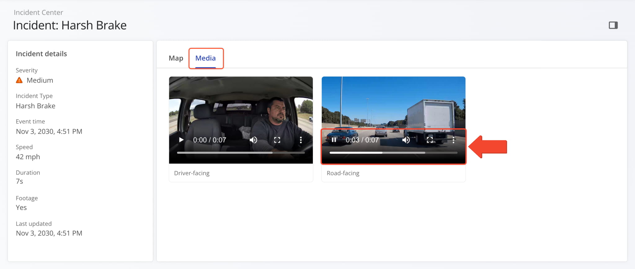
The “Media” tab shows each camera feed for the Incident side by side. Depending on the Vehicle, you can see driver-facing, road-facing, or other camera feeds. The video player supports standard controls for play, pause, volume, skipping, and full screen. You can also use the Three-Dot Icon menu to download videos.
Visit Route4Me's Marketplace to Check out Associated Modules:
- Route Optimization
Stops Bundling
- Route Optimization
Mixed Vehicles Routing
- Route Optimization
Max Weight per Route
- Route Optimization
Max Stops Per Route
About author: Kristian Andreev