
Incident Reports – View Vehicle Accidents And Road Incidents
Incidents can happen anywhere along a vehicle’s journey, from long-haul segments to the final stretch of a last mile optimized route. The Incidents tab, accessible from various Snapshots in your account, gives you visibility into every recorded safety event – pulled from your connected telematics devices and dash cams – along with the data, media, and location details tied to it. Whether you’re reviewing a single vehicle’s history or auditing incidents across a route, this guide walks you through how to access, configure, and interpret that information.
Table of Contents
Incidents Overview – View Safety Incident Details
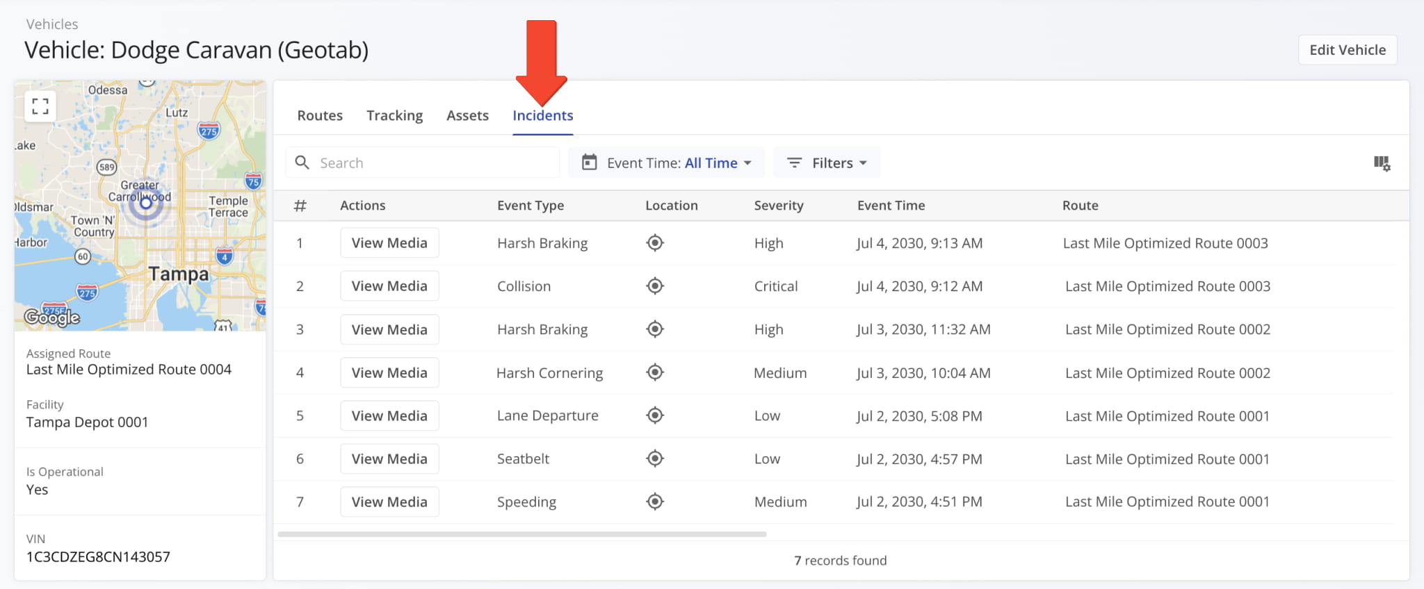
When opening a snapshot, the “Incidents” tab displays all recorded safety incidents along with their details. Incident details are organized into data columns – such as location, event type, and severity – that you can view, configure, and customize as needed.
To populate this data, a vehicle needs one or more dashcams or other media capture devices connected to a telematics vendor. Route4Me supports connections to numerous telematics vendors.
Once your devices are linked, incident data syncs automatically into your account and appears in the “Incidents” tab, including any available recordings accessible from the “View Media” button.
Incidents Data Sources – Telematics, Dashcams, And Car Accident Data
Route4Me doesn’t generate safety incident data itself. It’s pulled from your telematics devices and dash cams.
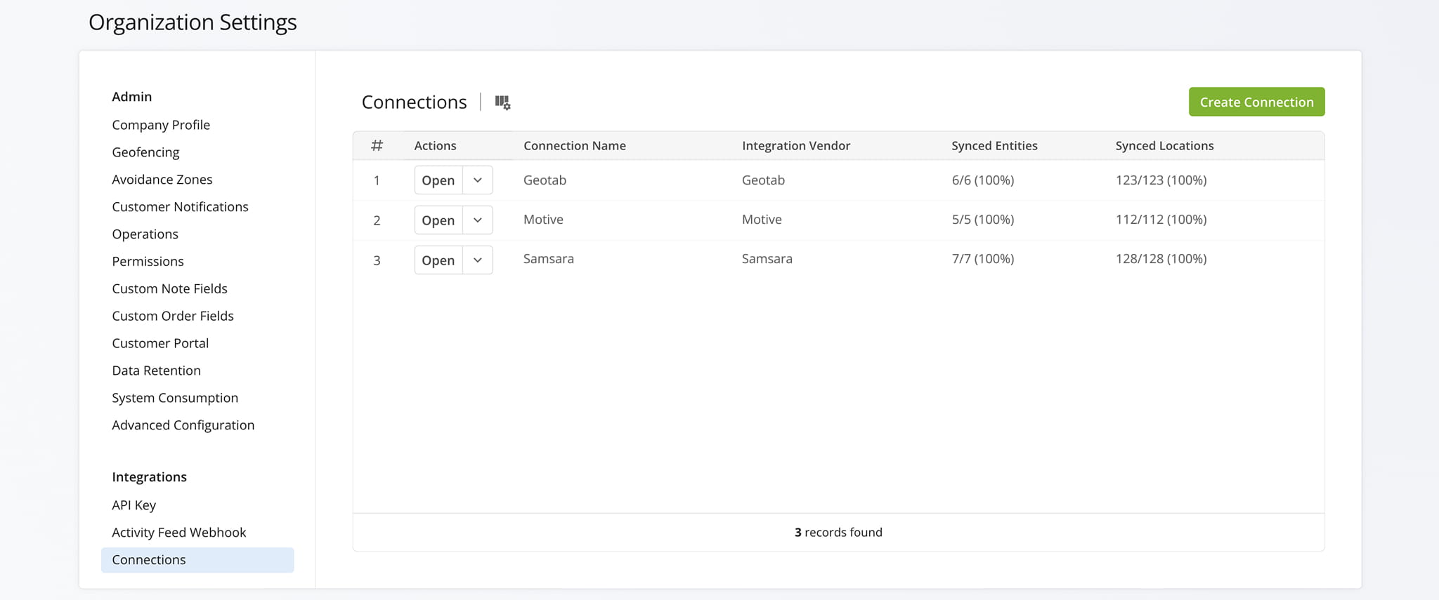
Incidents can be imported through telematics integrations with any supported vendor, such as Geotab, Samsara, Motive, and others. If you’d like to have incidents imported through your telematics connection, reach out to Route4Me Support.
Once you set up a Telematics Connection, events like car accidents, harsh braking, and other driving incidents sync automatically and appear across your Snapshots.
Open Your Telematics Connections
Opening The Incidents Tab – Access Incident Reports From Snapshots
The “Incidents” tab is available from several Snapshot types. To open it, navigate to a relevant Snapshot and select the “Incidents” tab. This tab displays the same information regardless of which Snapshot you access it from.
Vehicle Snapshot Incidents – View Incidents Recorded By A Specific Vehicle
When you open a Vehicle Snapshot, the “Incidents” tab shows all Safety Incidents recorded for that vehicle.
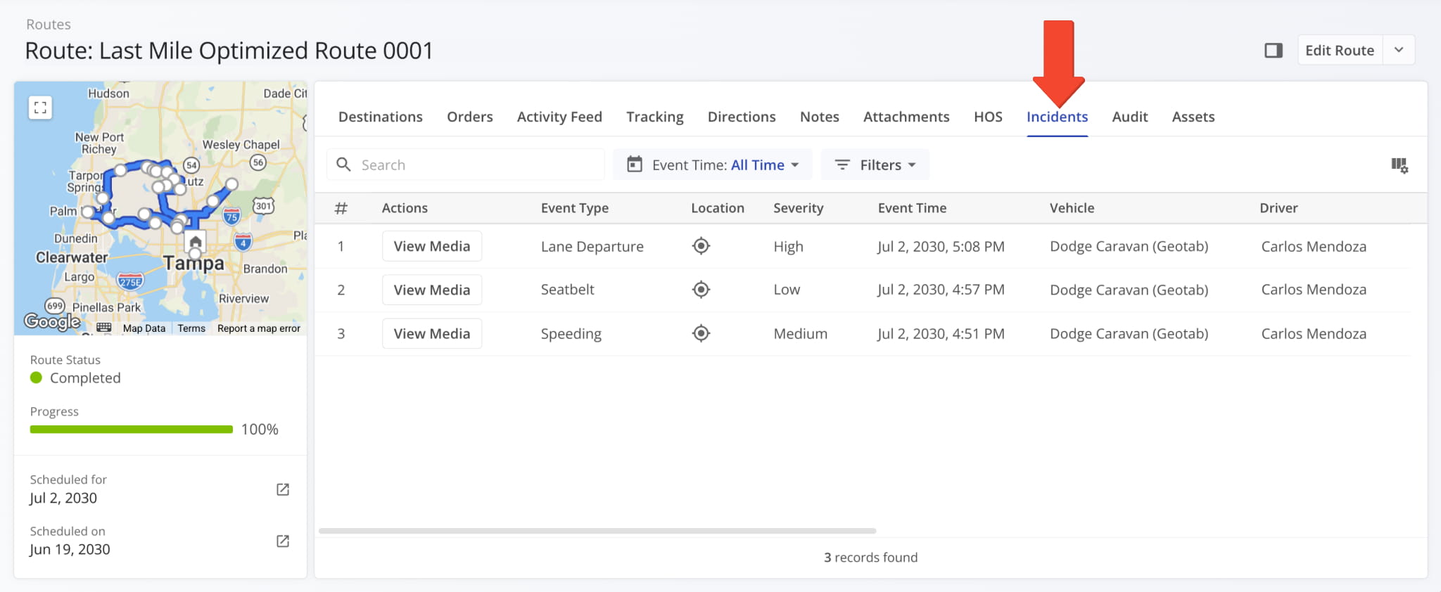
Route Snapshot Incidents – View Incidents Recorded During A Specific Route
The “Incidents” tab is also available in Route Snapshots, where it shows all Safety Incidents associated with that route.
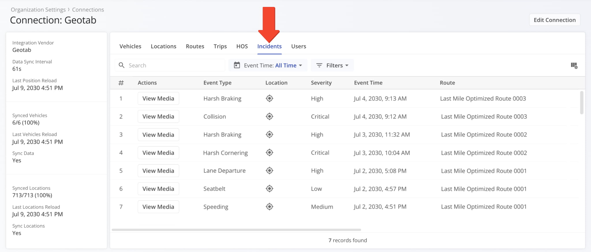
Telematics Connection Snapshot Incidents – View Incidents Recorded By Telematics Data
The “Incidents” tab is also available in Telematics Snapshots, where it shows Safety Incidents associated with a Telematics Connection and the vehicles imported from it.
Open Your Telematics Connections
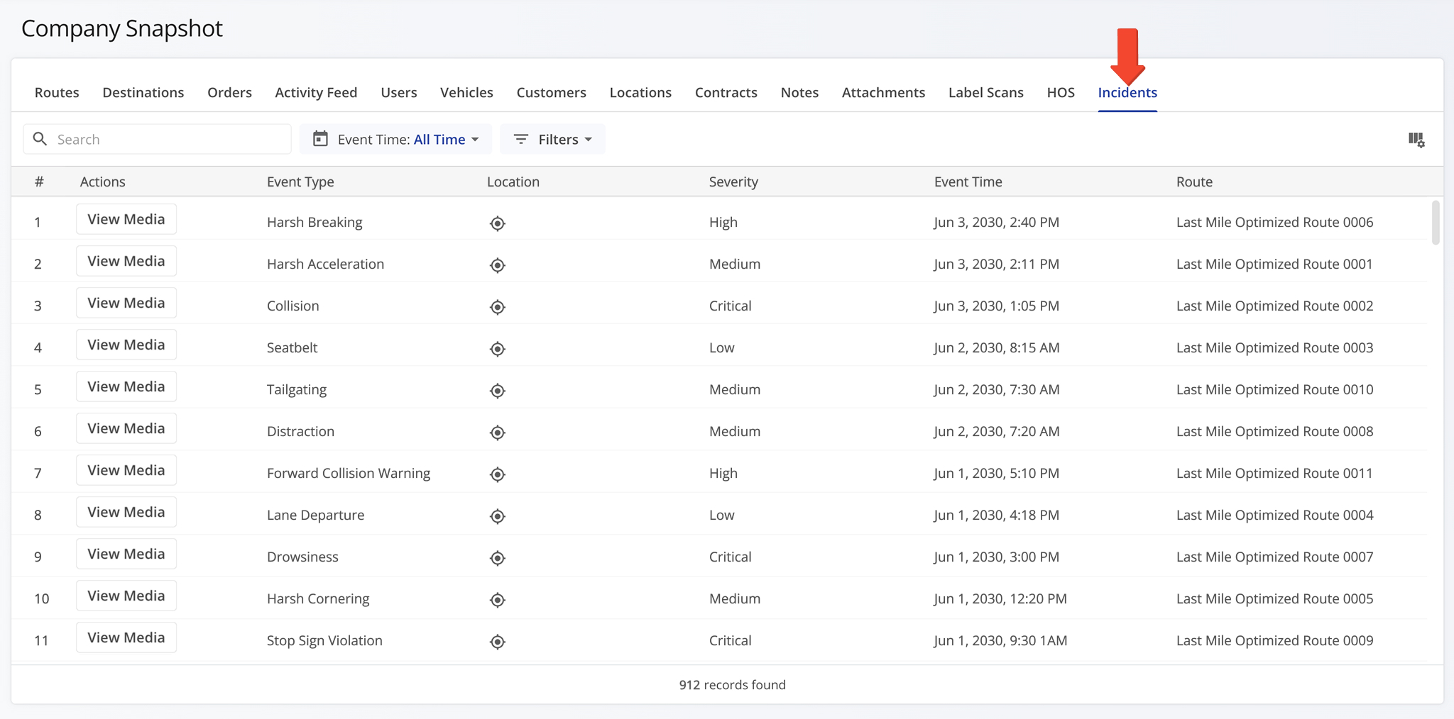
Company Snapshot Incidents – View Incidents Recorded Across Company Vehicles
The “Incidents” tab is also available in your Company Snapshot, where it shows Safety Incidents recorded across all vehicles associated with your company.
Customizing Incidents Data – Configure Columns, Filters, And Date Ranges
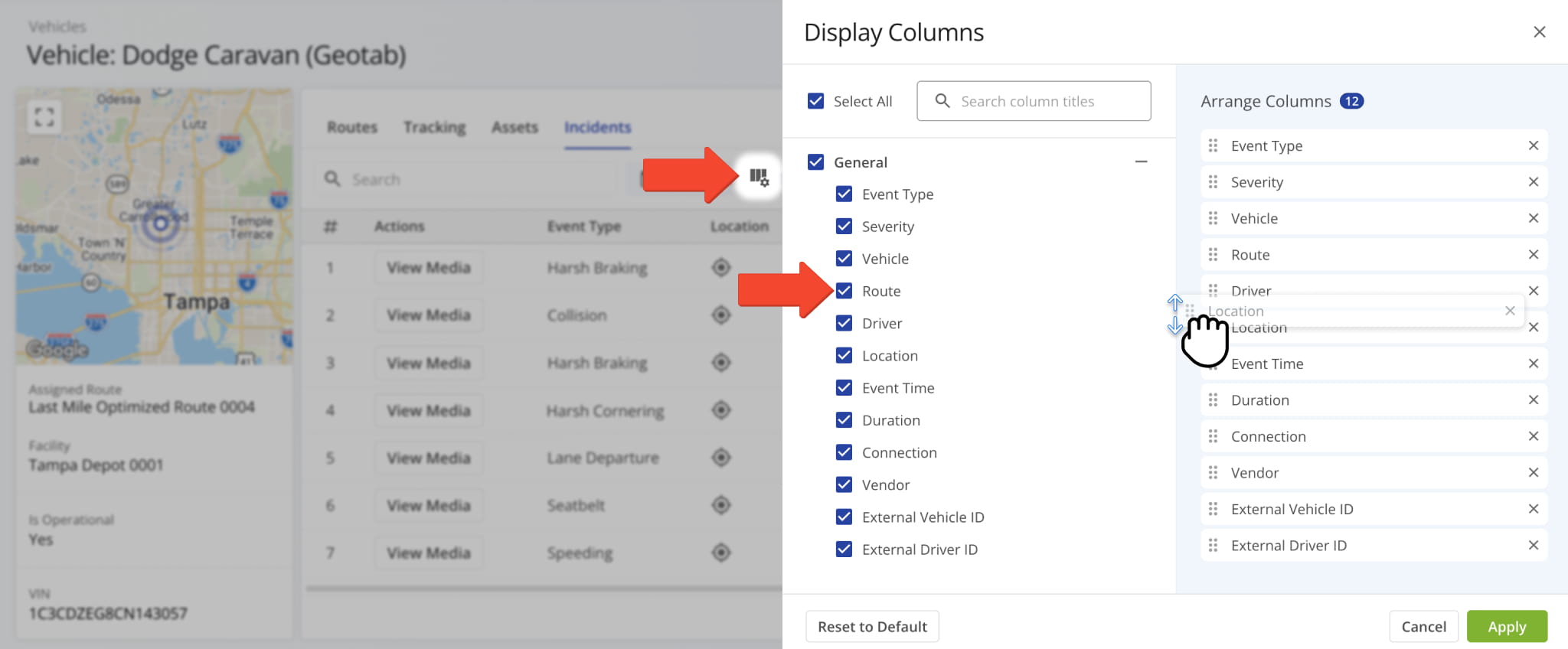
From any Incidents tab, click the Columns Icon in the upper-right corner to select which data columns appear in the table. Check the box next to each column you’d like to display, and drag to reorder them however best fits your workflow.
The table below details each available column and the data it displays.
Incidents – Data Table
Event Type
The type of incident detected, such as Collision, Tailgating, or Speeding.
Severity
The severity level assigned to the detected incident.
The vehicle associated with the incident. Click the Go To Icon next to the Vehicle to access its Vehicle Snapshot.
The route the vehicle was on when the incident occurred. Click the Go To Icon next to the route to access its Route Snapshot.
The driver associated with the incident. Click the Go To Icon next to the driver to access their User Snapshot.
The geographic location where the incident occurred. Click the Location Icon to view the location on a map.
Event Time
The date and time when the incident occurred.
Duration
The length of time the incident lasted.
The Telematics Connection associated with the incident.
The Telematics provider supplying data for the associated connection.
External Vehicle ID
Unique identifier assigned to the vehicle in the connected telematics system.
External Driver ID
Unique identifier assigned to the driver in the connected telematics system.
You can also narrow the data shown in the table by date or filter, as detailed in the table below.
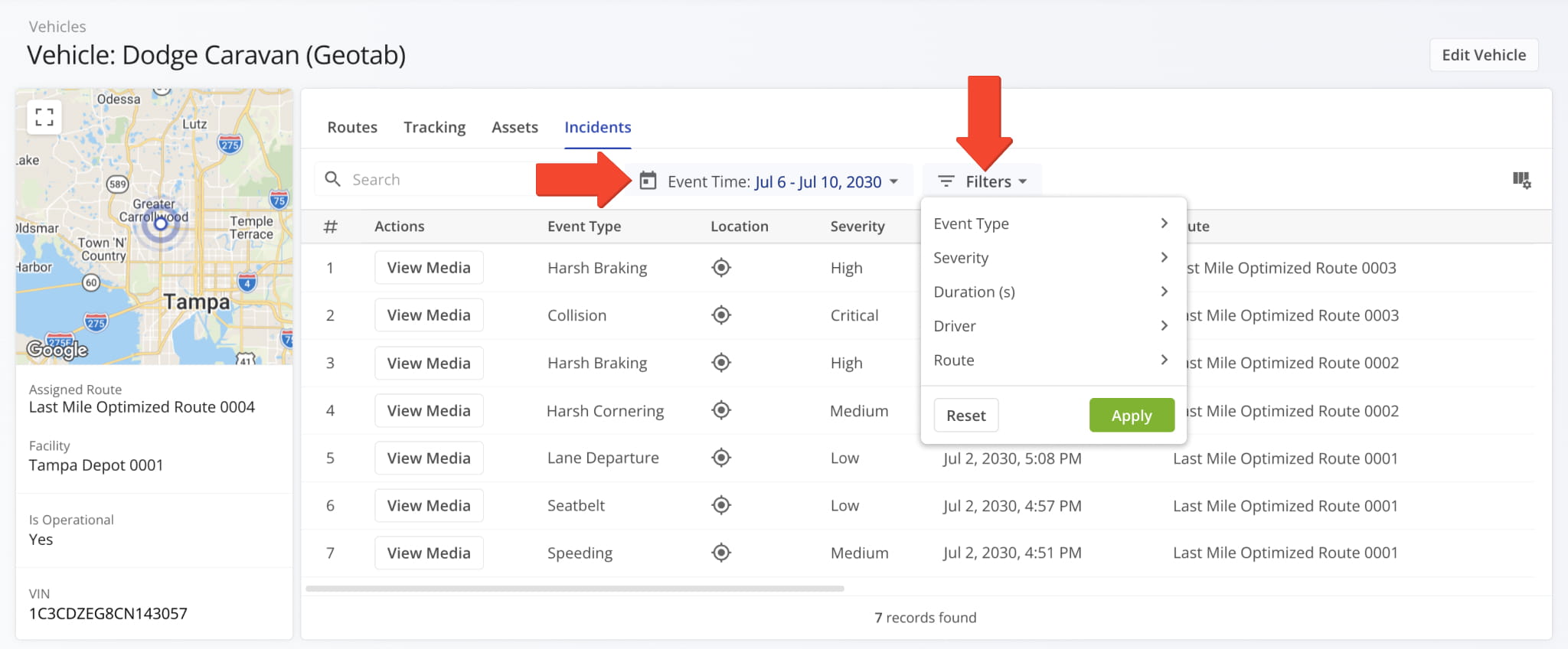
Incidents – Filters
Event Type
Filter incidents by the type of event detected.
Severity
Filter incidents by severity level: Low, Medium, High, or Critical.
Duration(s)
Filter incidents by a minimum and/or maximum event duration, in seconds.
Driver
Filter incidents by driver. Search for drivers by name or email.
Route
Filter incidents by route. Search for routes by name.
Event Types, one of the available filters, are explained below.
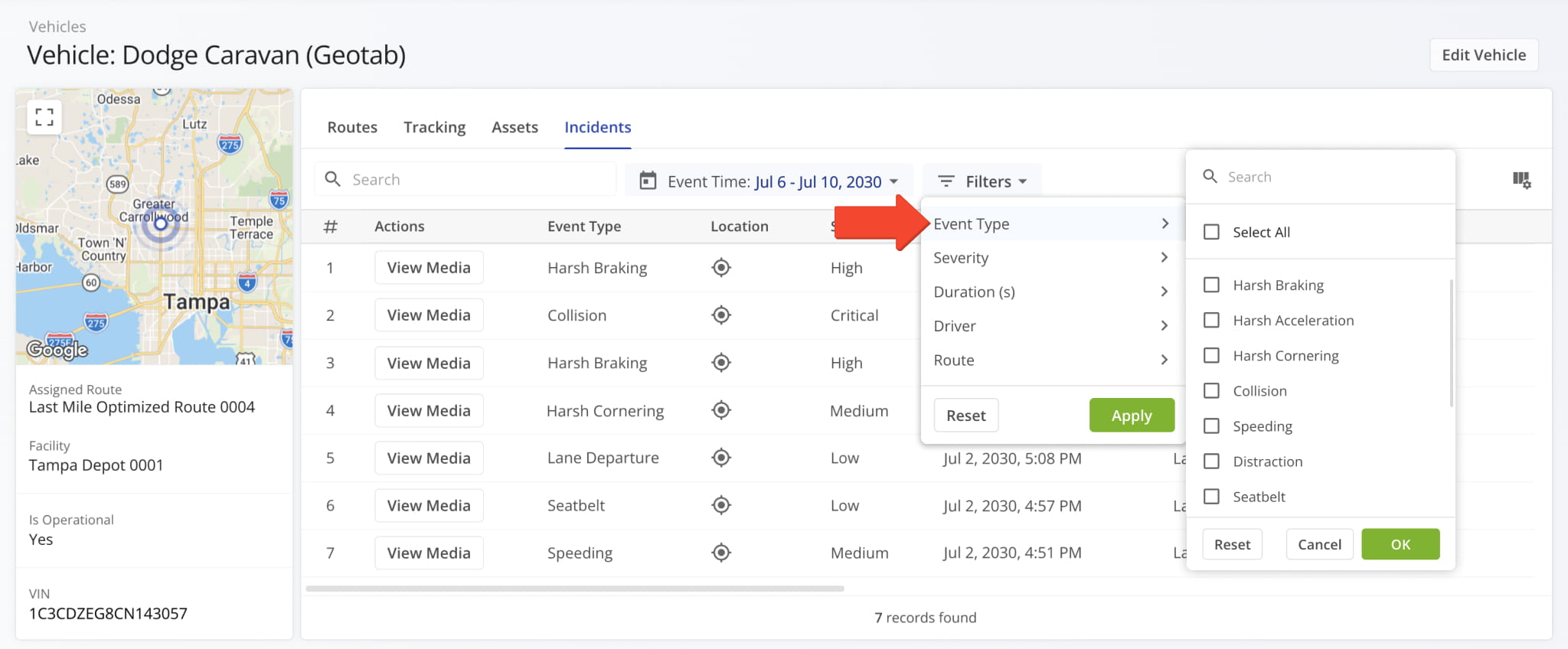
Safety Incident Event Types
Incidents Media – View Camera Footage And Incident Recordings
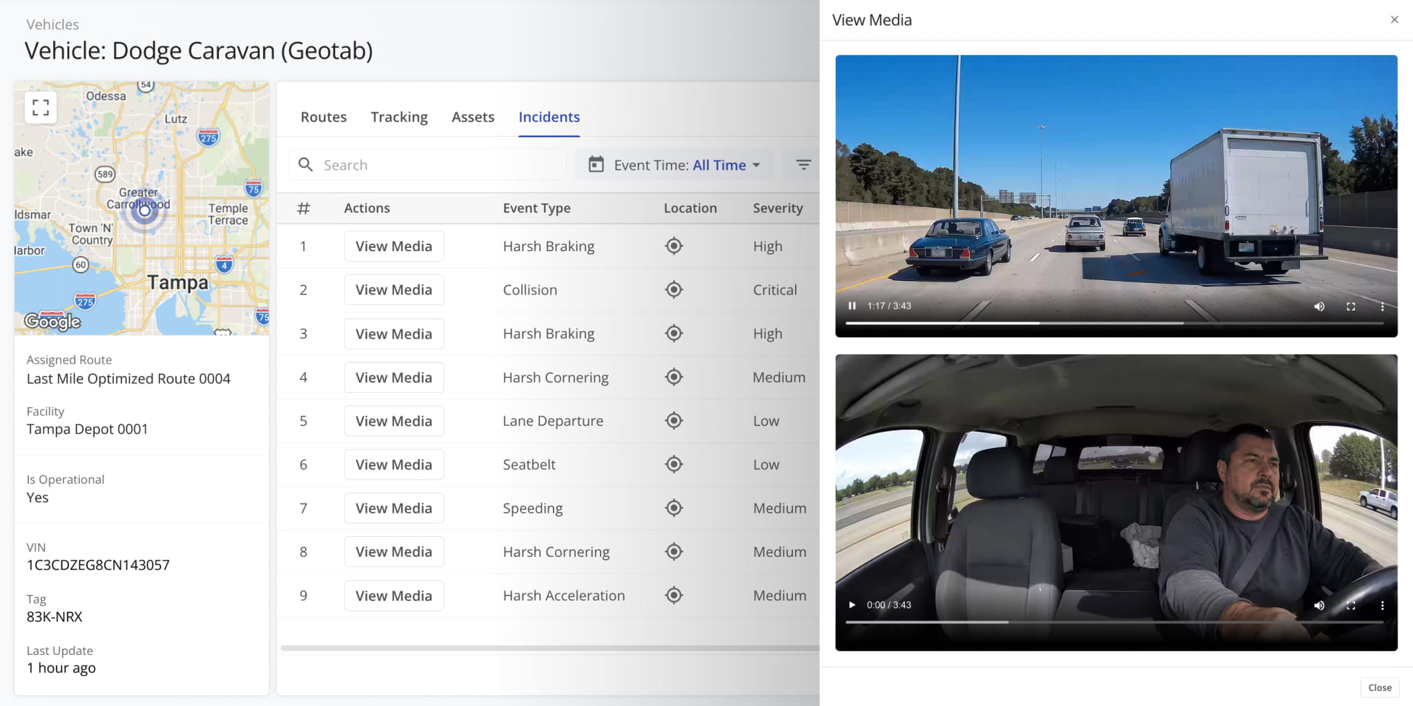
When a vehicle is equipped with one or more cameras or other media capture devices, incident recordings are automatically saved and attached to the corresponding incident in the system.
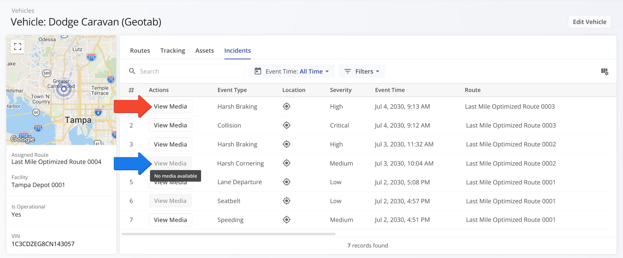
Click the “View Media” button to open the media player and inspect the recordings associated with an incident. If no media is available for that incident, the “View Media” button appears grayed out.
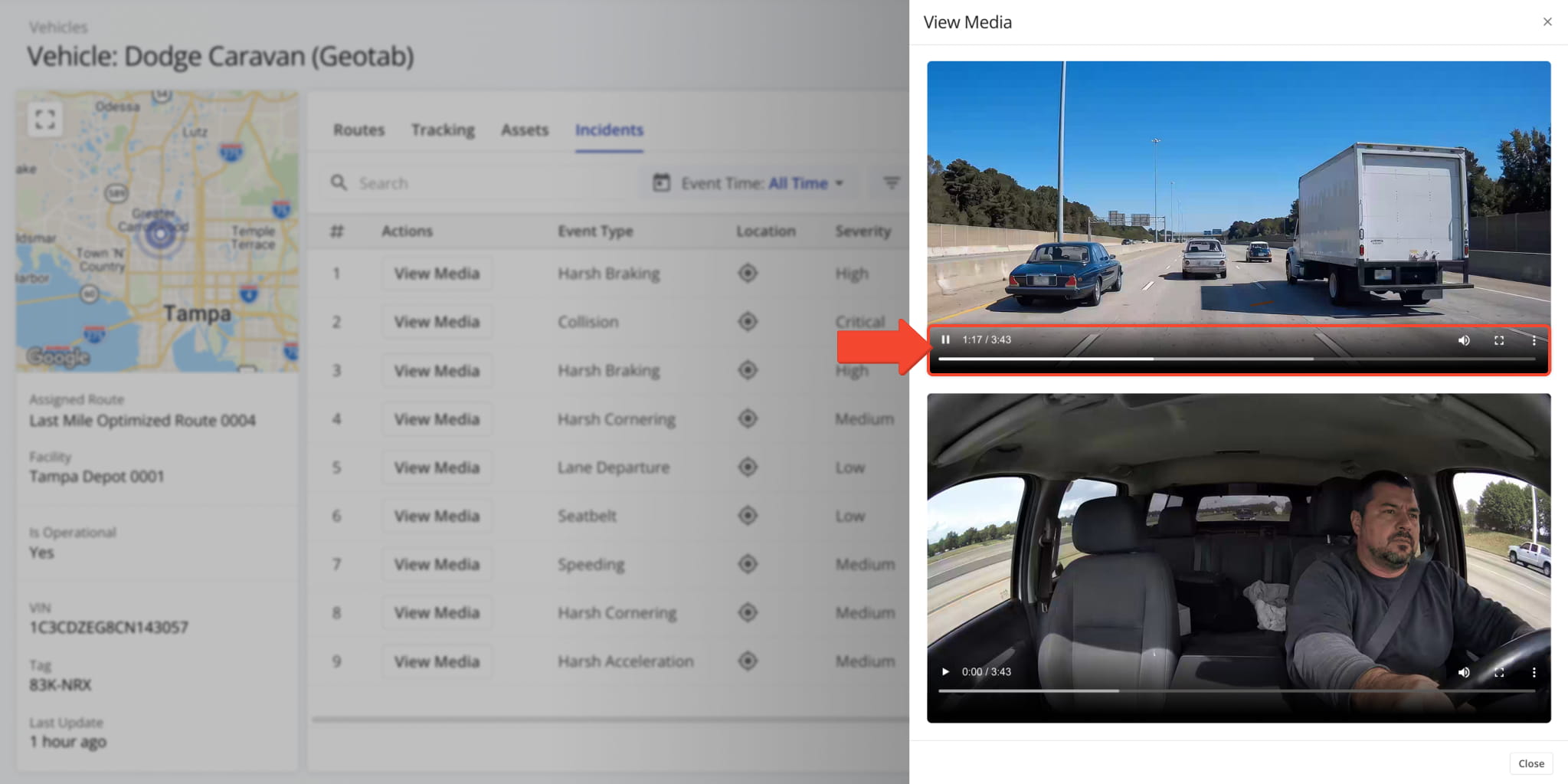
The media player displays footage from each available camera angle. For example, the footage might include a street-facing view showing the road ahead and/or an interior view showing the driver, depending on how the vehicle is equipped.
The player provides the following controls: Play/Pause, Volume, and Full Screen. A 3-dot menu offers additional options to download the media, adjust playback speed, and enable picture-in-picture.
Incident Locations – View GPS Coordinates And Map View
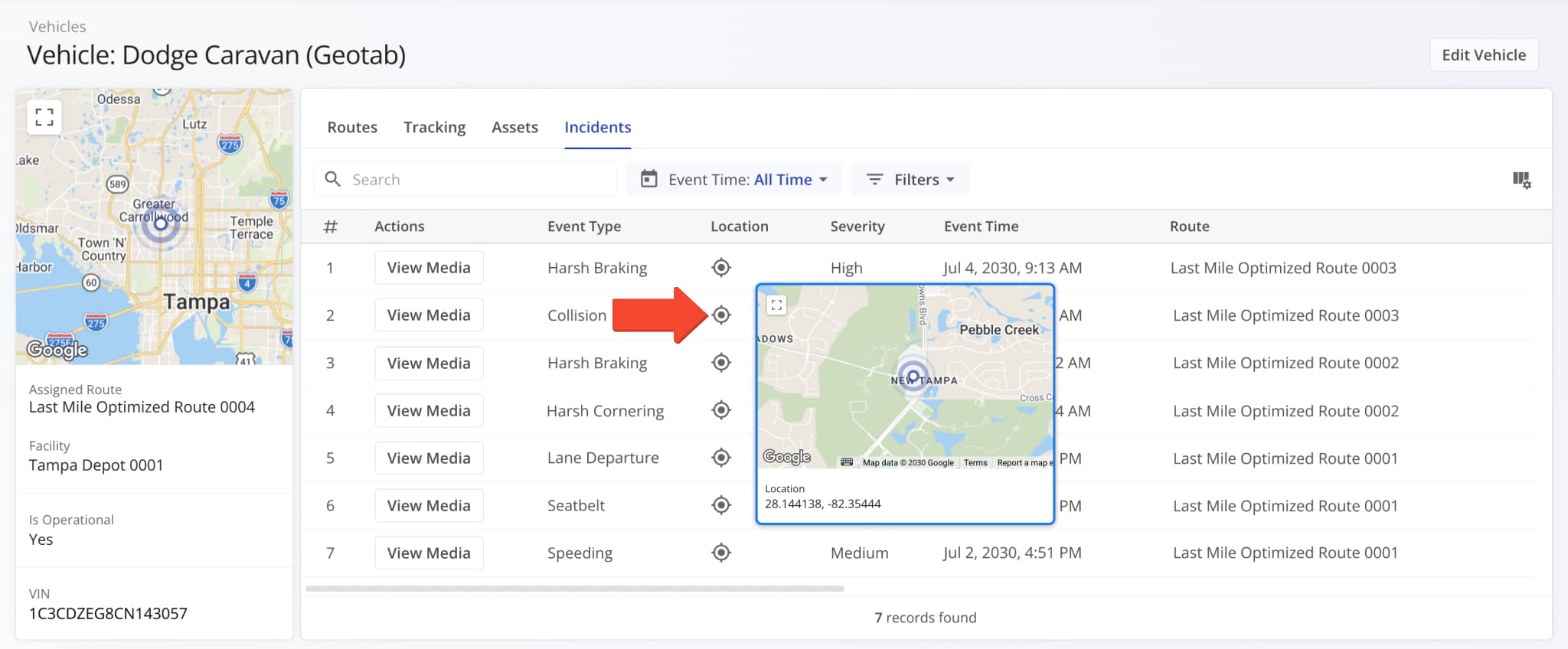
To view an incident’s location, make sure the “Location” column is configured in your data table. Once enabled, click the Location Icon in that column to open a map.
The map displays a GPS Icon marking the vehicle’s position at the moment of the incident, along with its coordinates (latitude and longitude). You can expand the map to a larger size for a closer look.
Supported Telematics Vendors – Compatible Incident Data Providers
Route4Me integrates with a range of telematics vendors to support Incidents data. The table below lists each supported provider.
Supported Telematics Vendors
Visit Route4Me's Marketplace to Check out Associated Modules:
- Route Optimization
Stops Bundling
- Route Optimization
Mixed Vehicles Routing
- Route Optimization
Max Weight per Route
- Route Optimization
Max Stops Per Route
About author: Daniel Archer