Incident Center – Monitor Route Incidents, Driver Safety Events & Dashcam Footage
The Route4Me Incident Center is a safety event dashboard where you can track and review all safety incident reports from connected Telematics Vehicles and devices. Safety events such as distraction, tailgating, speeding, harsh braking, and lane departures appear in one table, along with their severity, event time, and location on the map. You can see in-depth details for each event and watch recorded dashcam footage to identify and resolve safety issues and keep your fleet compliant.
Table of Contents
Incident Center Overview – Safety Incident Data Dashboard
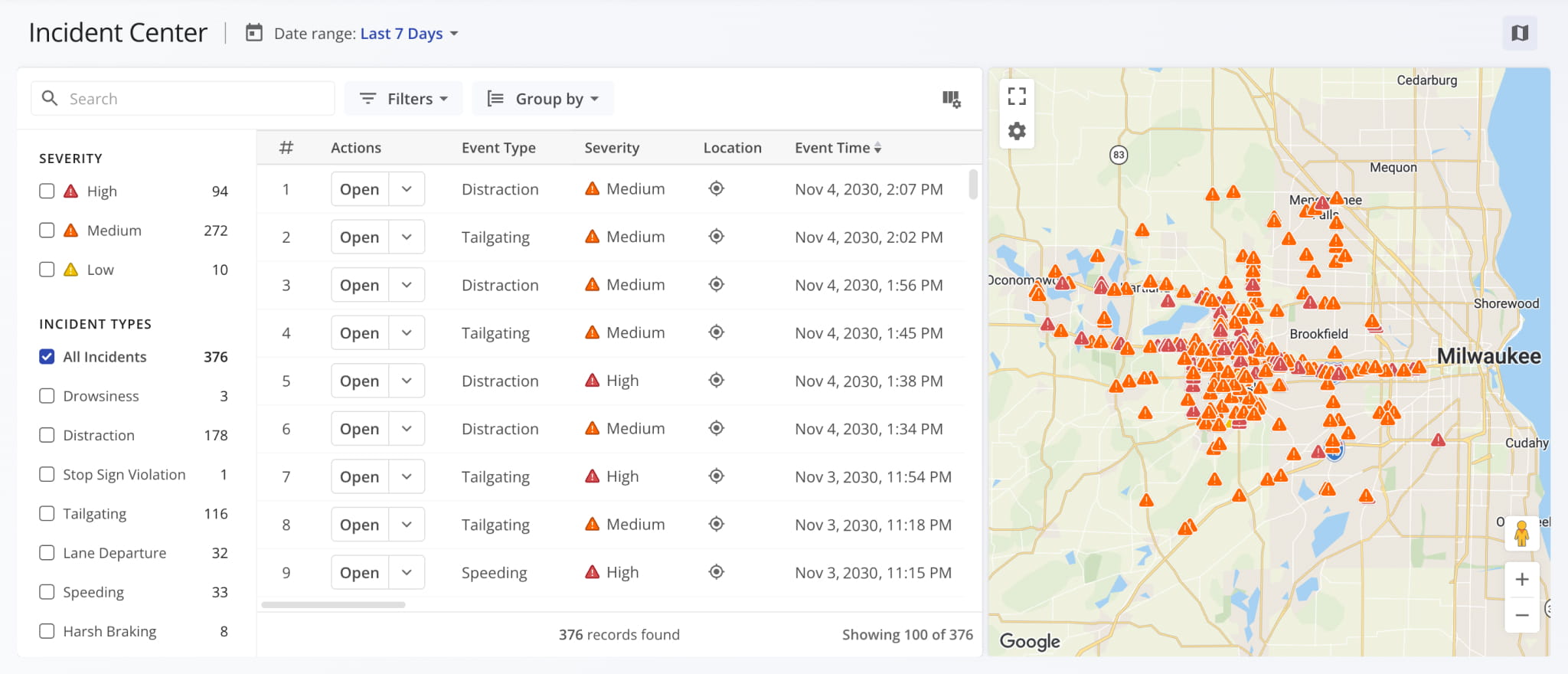
Data in the Incident Center is organized into columns such as Location, Event Type, and Severity. You can view, configure, and customize these columns as needed. To populate this data, a Vehicle needs one or more telematics devices, dashcams, etc. connected to a telematics provider. Route4Me supports connections to all major telematics vendors.
Once your devices are linked, incident data and footage sync to your account and appear in the Incident Center automatically.
To open the Incident Center, go to “Dispatch & Tracking” > “Incident Center” in the Navigation Menu.
Incident Data Sources – Telematics, Dashcams & Vehicle Accident Data
Route4Me doesn’t generate safety incident data directly. Incidents can be imported through telematics integrations with any supported vendor, such as Geotab, Samsara, Motive, etc. Once you set up a Telematics Connection, events like accidents, harsh braking, and other safety incidents automatically sync with your Incident Center and Snapshot Incident Reports.
NOTE: If you’d like to have Incidents imported through your telematics connection, reach out to Route4Me Support.
Open Your Telematics Connections
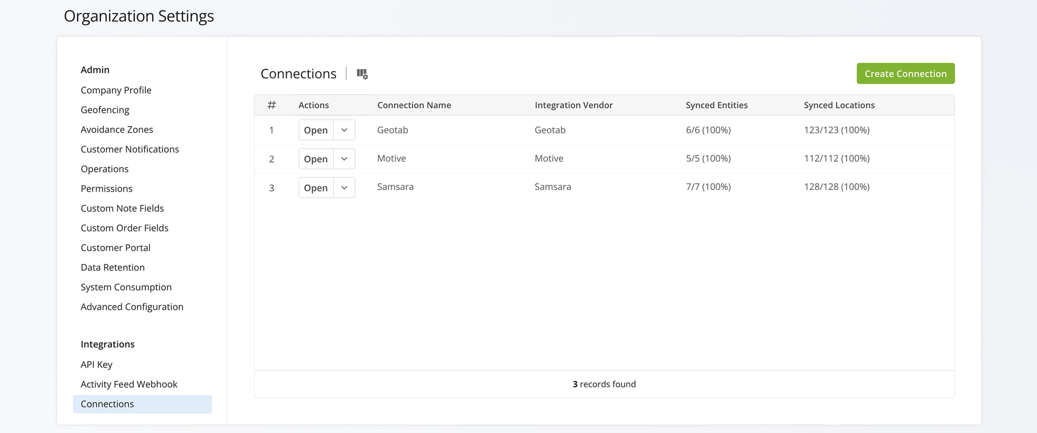
Route4Me integrates with a range of telematics vendors to support Incident data. The table below lists each supported provider.
Safety Incidents - Supported Telematics Vendors
Customize Incident Data – Configure Columns, Filters, Grouping & Date Ranges
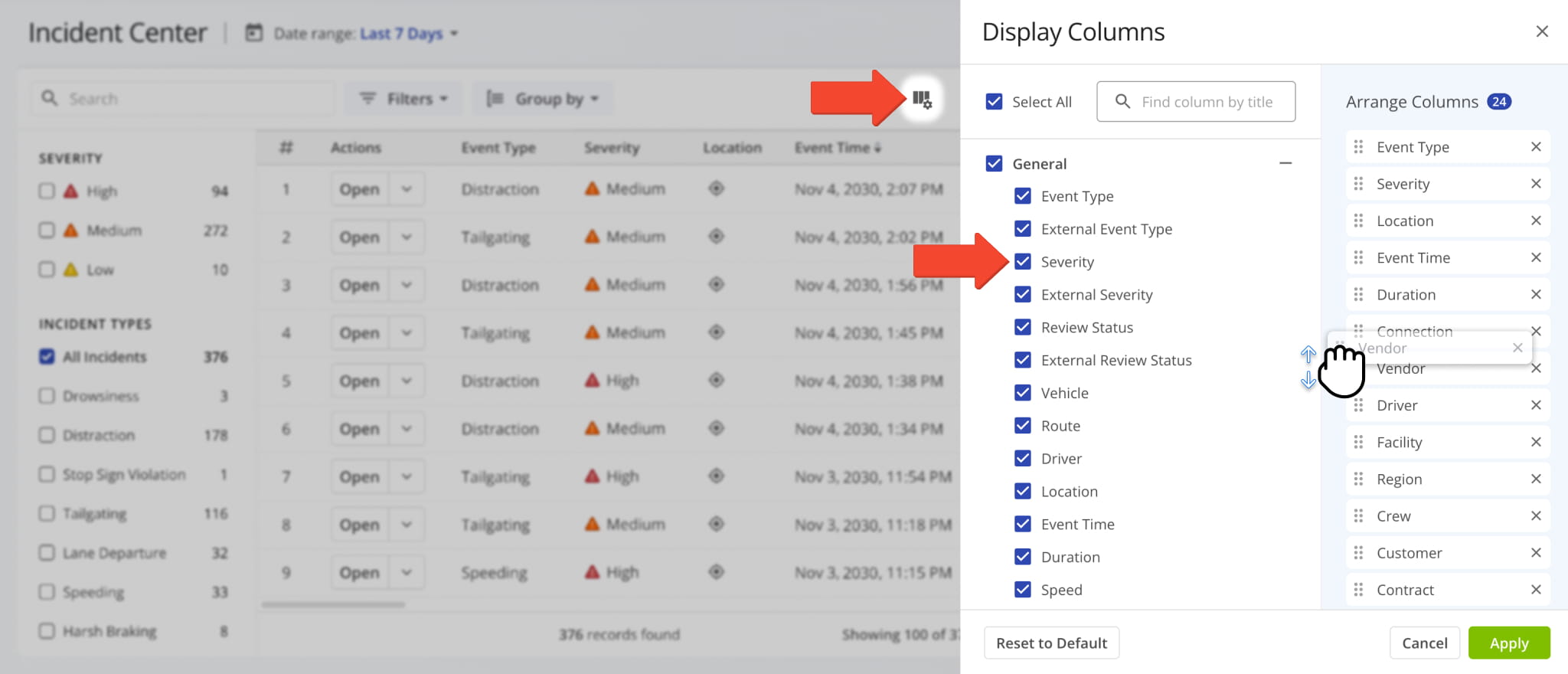
To customize data columns on the Incident Center, click the Columns Icon in the upper-right to open the “Display Columns” panel. Check the box next to each column you’d like to enable and click and drag to reorder them. Click “Apply” to finalize.
The table below details each available column and the data it displays.
Incident Center - Incident Data Columns
You can also filter and organize the data in the table by date, filter settings, or grouping type as detailed in the tables below.
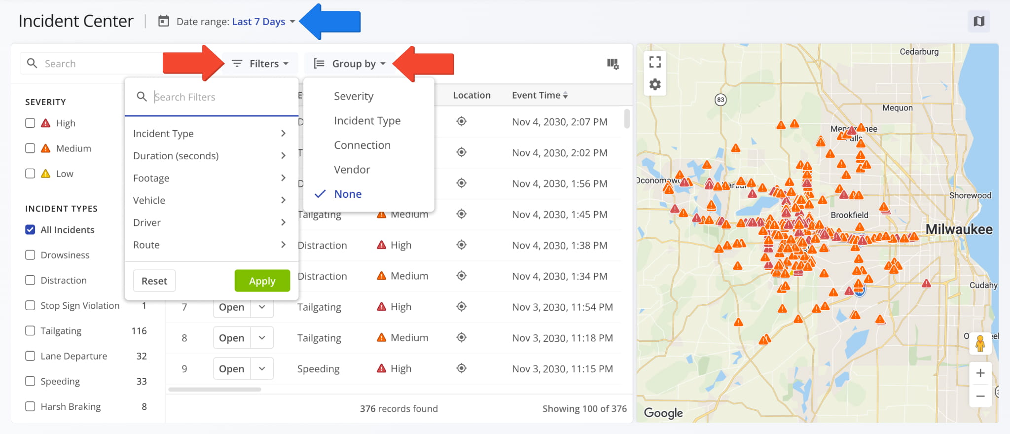
Incident Center - Filter Options
Incident Center - Grouping Options
Supported Incident Types & Severity Levels
To narrow down Incident Center data and find the Safety Incidents most relevant to your needs, you can use the “Severity” and “Incident Types” checkboxes in the left-side panel on the Incident Center.
Specifically, the Incident Center will only show the Incidents that match the checked Severity Levels and Incident Types. If you’ve enabled a “Group by” option, Incidents will be grouped into collapsible categories based on your settings.
See the table below for a full list of supported Incident Types.
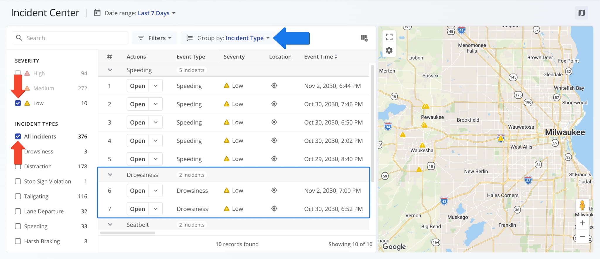
Safety Incident Event Types
Incident Center Map – Configure Incidents Map Layers & Settings
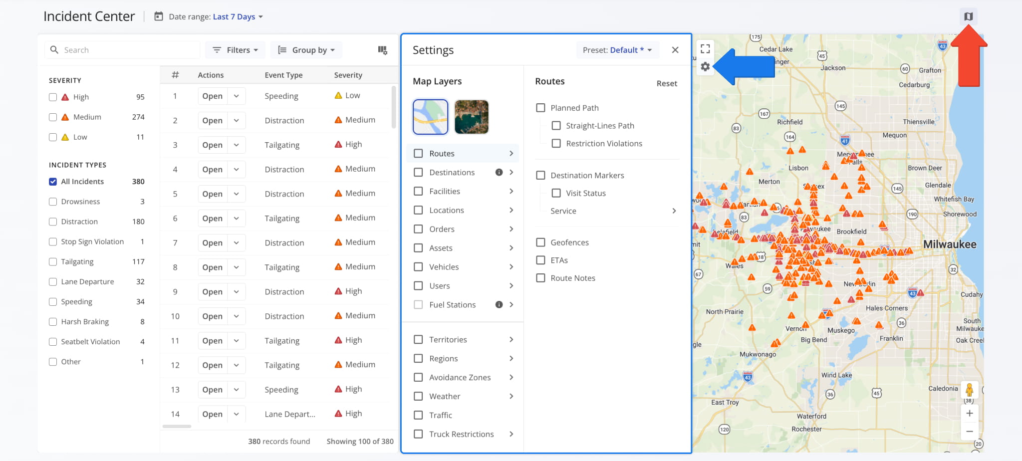
The Incident Center map shows the location of each route incident as a marker, color-coded by severity. To show or hide the map, click the Map Icon in the upper-right corner of the Incident Center.
Click the Gear Icon to open the “Settings” panel where you can switch map views and enable and customize Map Layers to see Incidents in the context of your operations. Learn more about Route4Me Map Layers & Settings.
View Route Incident Details – Locations, Safety Data & Dashcam Footage
Each Incident in the Incident Center includes data for its coordinates, severity, speed, and duration, plus the Vehicle, Driver, and Route involved. You can preview an Incident on the map, open its full details, and watch dashcam footage if it’s available.
Incident Map Locations – Preview Incident Overviews On The Map
To see where an Incident occurred, click it in the list or click its Location Icon in the table. The map zooms to the Incident’s marker. Map markers are color-coded by severity: Red = “High“, Orange = “Medium“, Yellow = “Low“.
You can hover over an Incident’s map marker to see a pop-up with the Incident’s key details. Switch between the “Overview“, “Source“, and “Location” tabs in the pop-up to see the details listed in the table below.
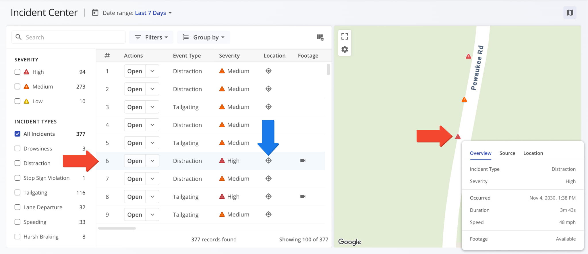
Incident Center Map - Incident Details
Incident Details Panel – Open Incidents To See In-Depth Details
To view the full details of an Incident, click Open next to it or the Camera Icon in the “Footage” column, which appears when an Incident has dashcam footage. The Incident details panel opens on the right side of the screen.
Alongside other details, the panel lists the route, Vehicle, Driver, Telematics Provider, and Telematics Connection associated with the Incident. Click the Link Icon to open their respective snapshots. See the table below for a full list of fields.
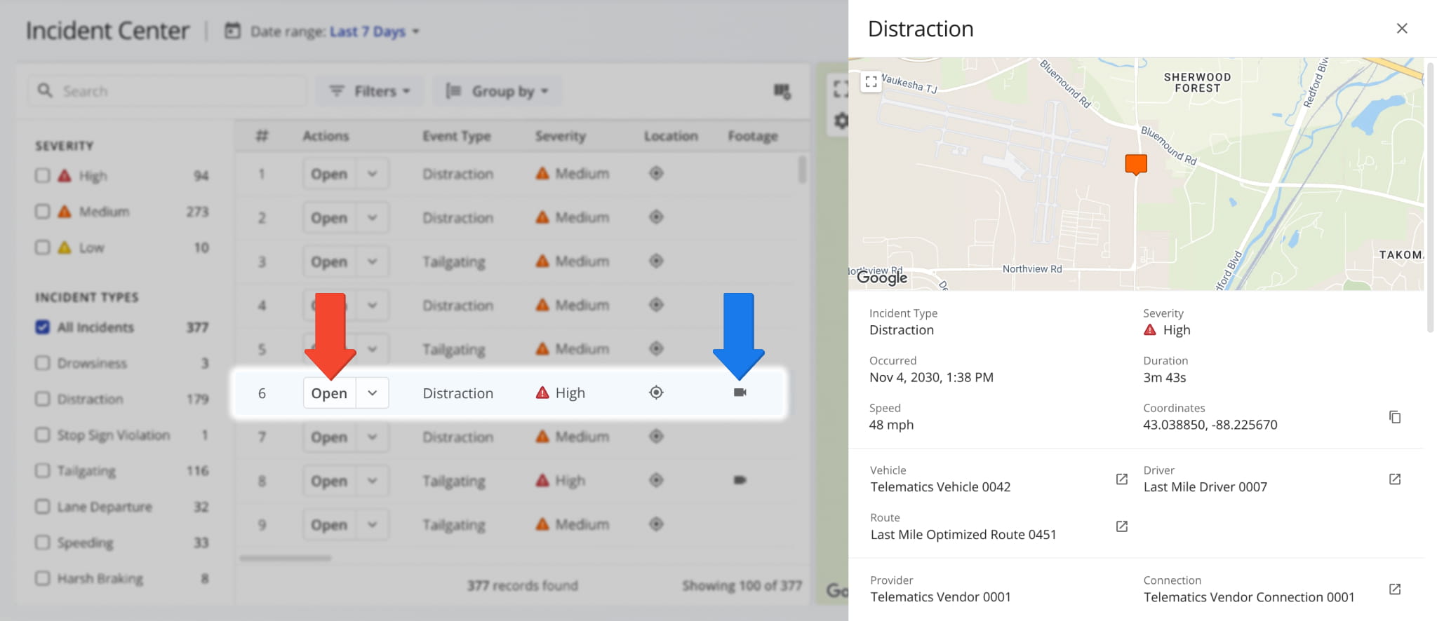
Incident Center - Incident Detail Fields
Dashcam Recordings – Watch Safety Incident Footage From Vehicles
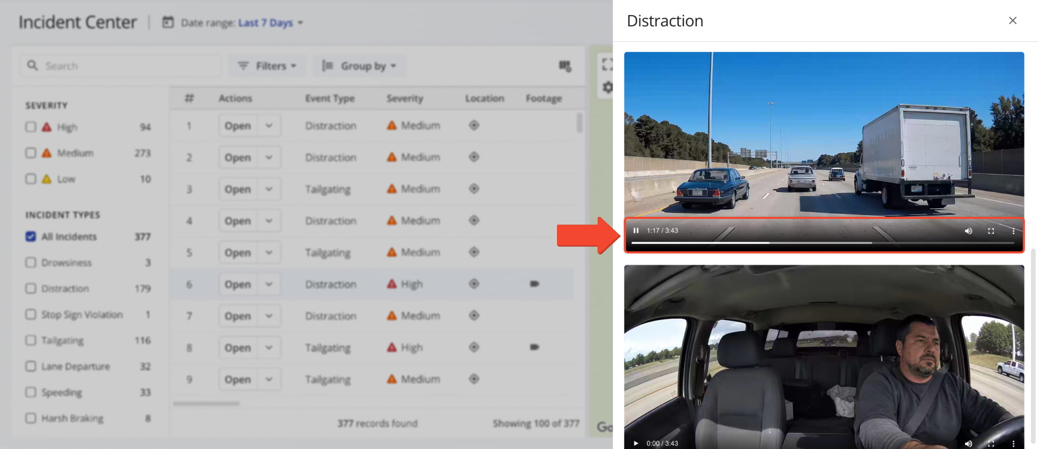
To watch recorded Incident footage, if it’s available, open the Incident and scroll down in the details panel.
Depending on the Vehicle, the panel can show road-facing, driver-facing, or other videos. The video player supports standard controls for play, pause, volume, skipping, and full screen. You can also use the Three-Dot Icon menu to download videos.
Incident Snapshots – Open Full Incident Reports With In-Depth Data
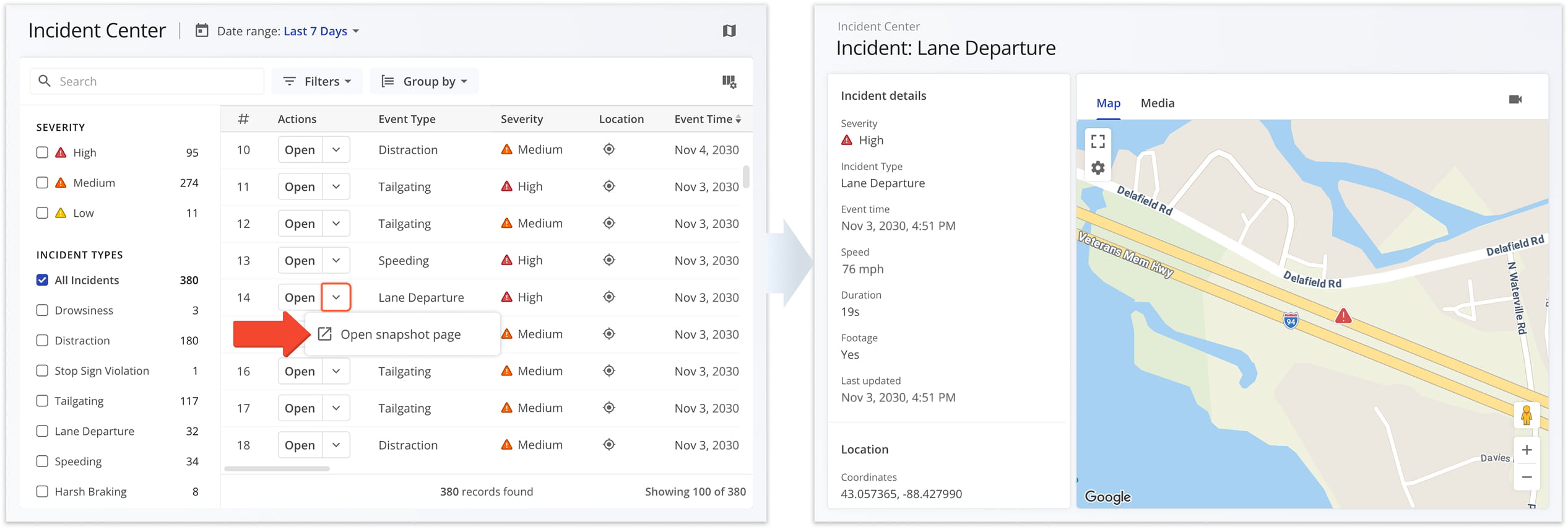
Each Incident also has its own Incident Snapshot page, with the Incident’s complete details, map location, and media in one view.
To open an Incident Snapshot, click the arrow next to “Open” and select “Open snapshot page“.
Visit Route4Me's Marketplace to Check out Associated Modules:
- Route Optimization
Stops Bundling
- Route Optimization
Mixed Vehicles Routing
- Route Optimization
Max Weight per Route
- Route Optimization
Max Stops Per Route
About author: Kristian Andreev