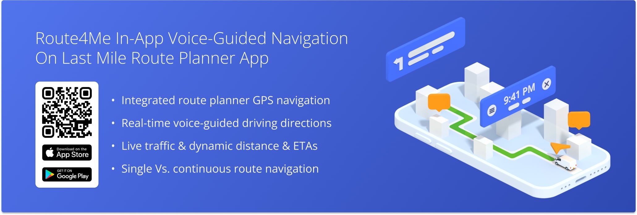
Navigate Dispatched Routes With In-App Voice-Guided GPS Navigation
Route4Me’s Multi Stop Route Planner app provides seamless continuity for users and drivers as they navigate and complete routes. The app supports integrated GPS navigation, allowing you to easily navigate your dispatched routes without switching between different apps. Specifically, in-app navigation supports voice-guided driving directions for driver safety, walking and bicycling directions, adjustable 3D maps, dynamic ETAs, live traffic, and more.
NOTE: If your route includes commercial vehicles, not all areas may support truck-safe routing. See where Route4Me provides commercial navigation to plan accordingly.
Table of Contents
Using Android Route Planner In-App Voice-Guided GPS Navigation
Tap the Burger Button in the top-right, then tap “Routes” or “View All Routes” to open the Routes List.
To see dispatched routes assigned to you, tap “My Routes“. Swipe down on the Routes List to refresh and load the most recent data. You can also tap the Search Icon to find routes by name, scheduled month, city, or other attributes.
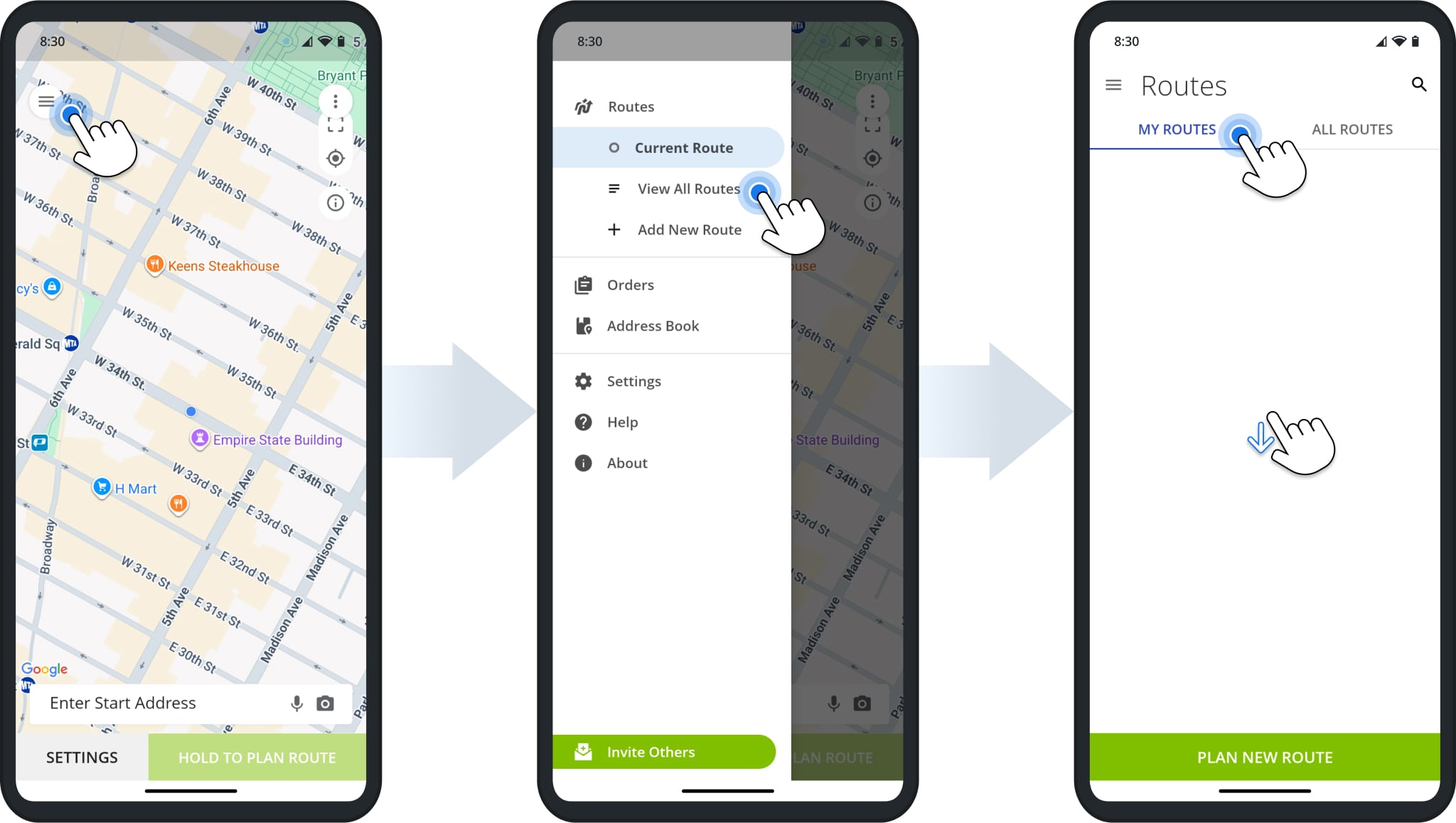
Tap a route to open it. Alternatively, tap the Three-dot Icon in the Routes List and select “Open Route” from the menu. Next, simply tap “Start Route” to open the first destination and change the route’s status to “Started“.
Additionally, you can swipe left or right to scroll through route destinations.
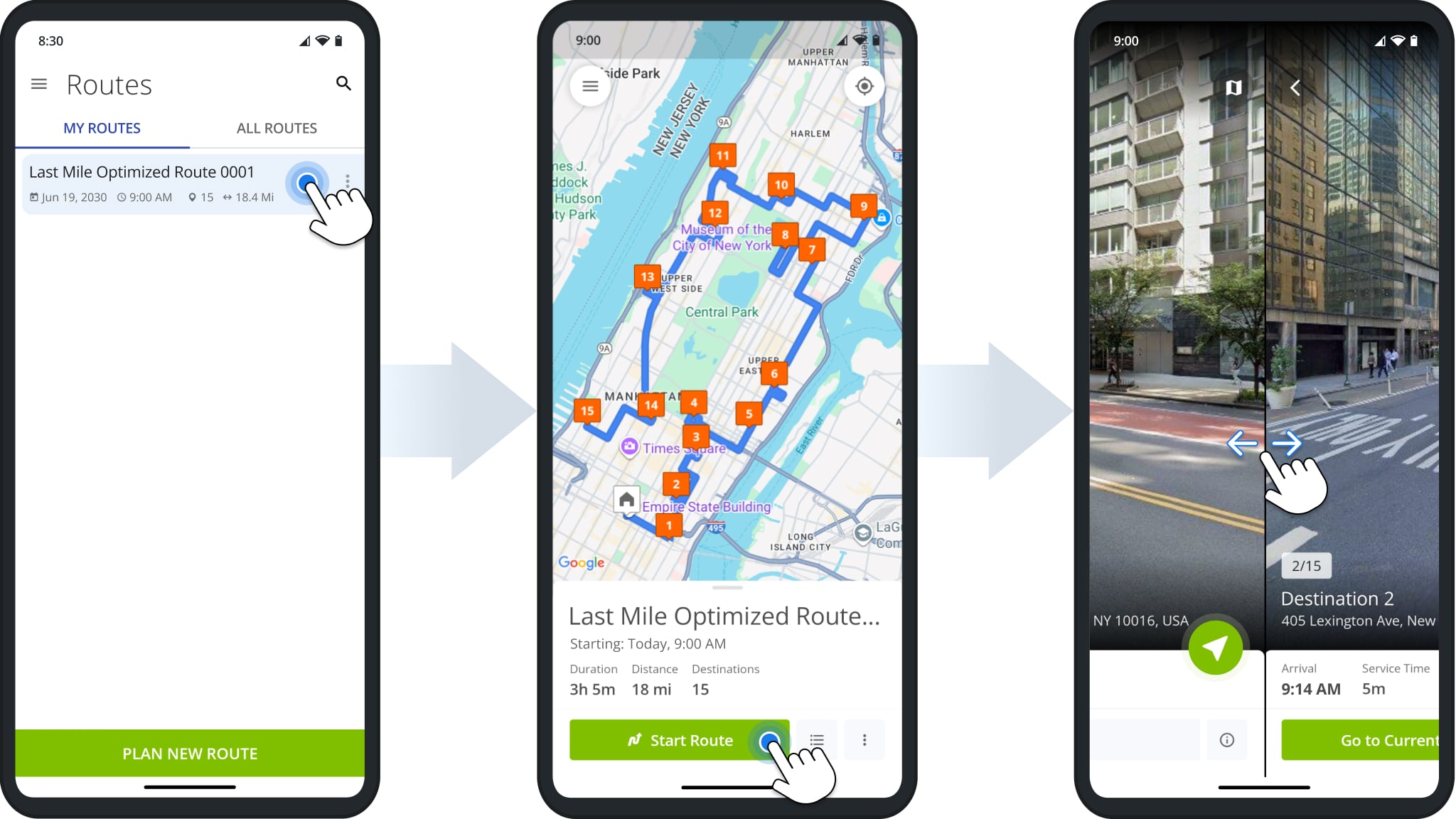
NOTE: When opening an already started route, “Start Route” is replaced with “Navigate“.
Once you’ve started or continued a route, you’ll see the next destination in the route sequence. To start navigating to the destination, simply tap the Navigate Button and select “Route4Me In-App Navigation“.
After the first time you select a navigation app, it’ll be set as your default navigation method. You can easily change your Navigation Preferences from the Route4Me App Settings described further in this guide.

At the top of the navigation map, you can see live turn directions. Every turn is automatically voiced by the app. At the bottom of the GPS navigation map, you can see your estimated time and remaining navigation distance to the destination.
Route4Me’s in-app navigation factors in traffic and other real-time conditions, so the navigation ETA can change accordingly while navigating the route. Further, you can learn how to enable Single Stop Navigation and Continuous Route Navigation.
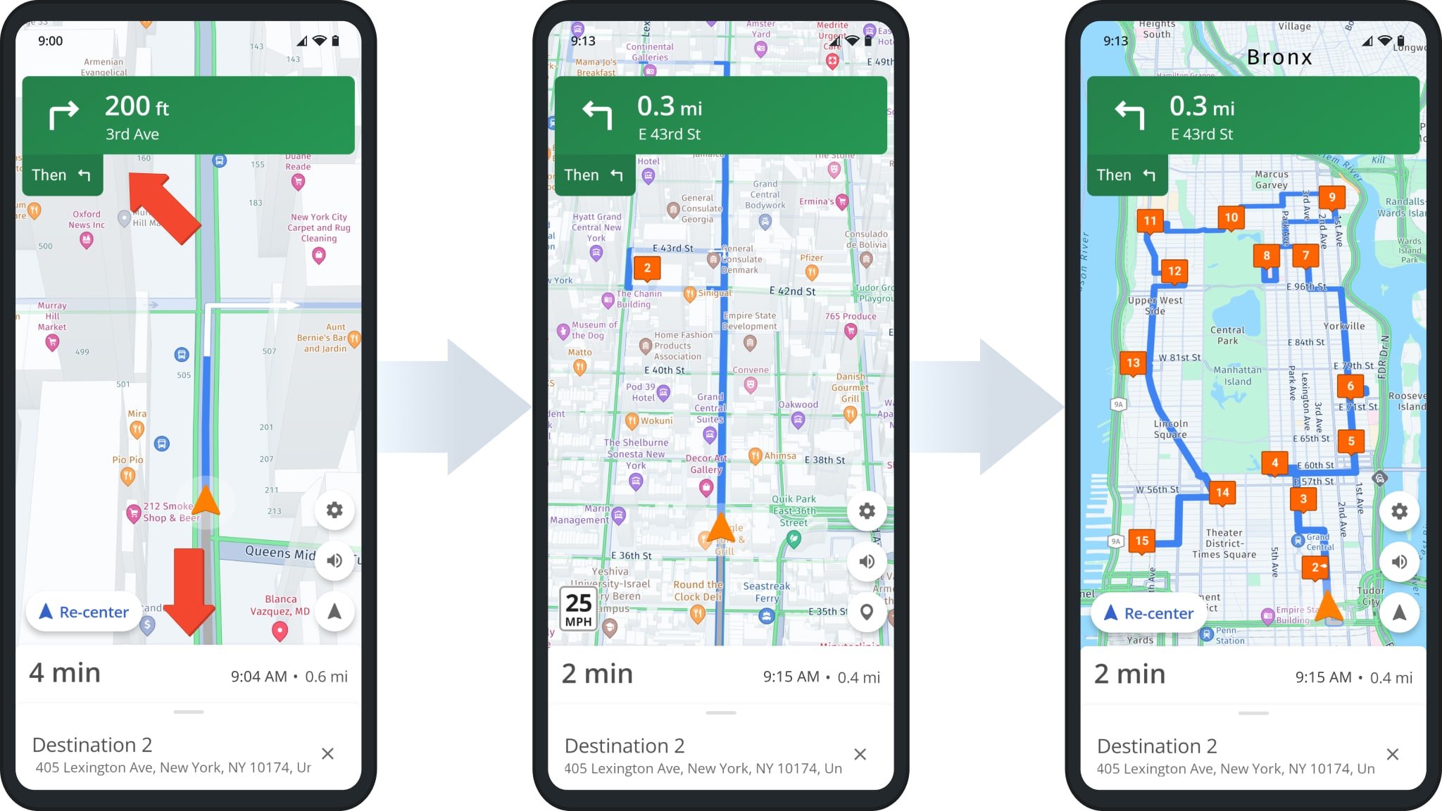
NOTE: The Navigation Map supports standard control gestures you’re familiar with, i.e. two-finger pinch to zoom in and out, two-finger swipe up and down to tilt, and two-finger rotation to rotate the map.
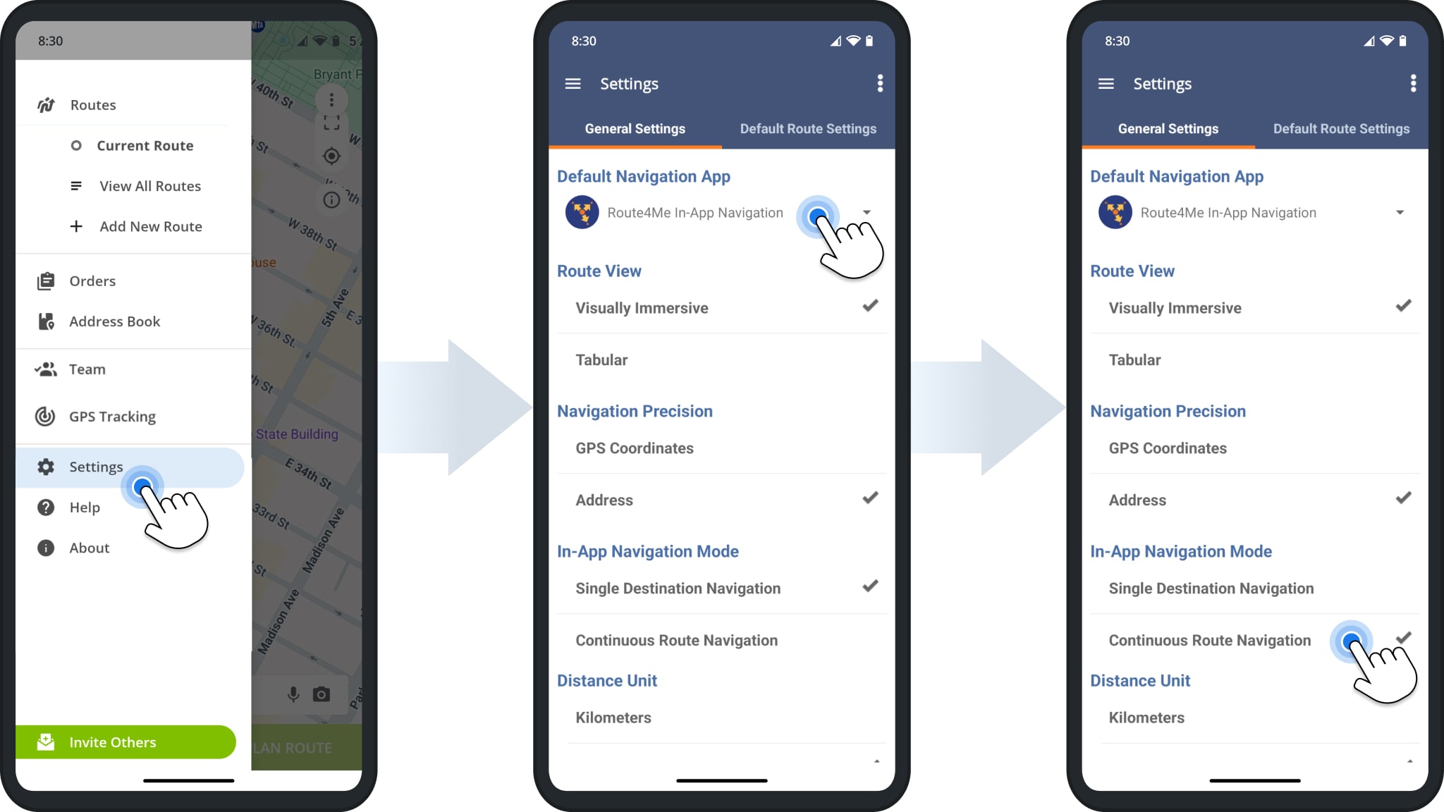
Route4Me Android Route Planner In-App Navigation Settings
To change your navigation settings, go to “Settings” in the app’s menu where you can adjust the following:
Navigate Dispatched Routes With In-App Voice-Guided GPS Navigation
Default Navigation App
When you start navigation, the respective route stop will be automatically sent to the selected Default Navigation App: Route4Me's In-App Navigation, Google Maps, HERE WeGo, CoPilot GPS, Waze, Uber, etc. For the most optimal and accurate navigation directions and experience, we recommend using Route4Me's In-App Navigation.
Route View
Change between standard tabular and visually immersive route view modes.
Navigation Precision
Select whether navigation should be based on destination coordinates or street address.
In-App Navigation Mode
"Single Stop Navigation" allows you to navigate to one stop at a time. "Continuous Route Navigation" allows you to navigate the entire multi-stop route without closing navigation.
Distance Units
Select the preferred distance unit: "miles" or "kilometers". The selected unit will be used in the in-app navigation and all other app interfaces.
Single Destination Vs Continuous Route Navigation
The image below shows the difference between navigation modes. Specifically, “Single Destination Navigation” is used to navigate to one location, and navigation closes once you’ve arrived.
With “Continuous Route Navigation“, the whole route is visible in the navigation interface, and it remains open after arriving at and completing destinations.
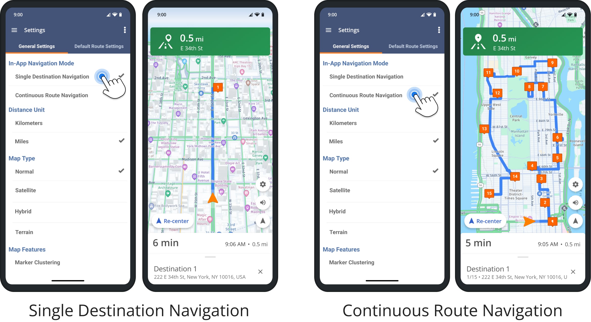
NOTE: The “In-App Navigation Mode” setting applies to Route4Me’s integrated navigation only. Third-party GPS navigation apps only support single-stop navigation.
Visit Route4Me's Marketplace to Check out Associated Modules:
- Operations
Custom Data Add-On
- Operations
Advanced Team Management Add-On
About author: Kristian Andreev
Kristian is a Technical Writer at Route4Me. With over a decade of experience in writing and localization, he's an expert at communicating complex technical data in a clear, concise, and user-friendly way. Passionate about bridging the gap between engineers and users, he specializes in creating documentation to streamline onboarding, enhance product usability, and support global teams on the path to success.