Curbside Routing – Route Planning And Optimization For Curbside Drop Off
Route4Me’s route optimization software helps plan efficient, cost-effective routes with multiple stops, offering both rooftop and curbside routing to meet different delivery needs. Rooftop routing guides drivers to the exact building, ideal for precise deliveries, while curbside routing directs them to the nearest accessible point, saving time and fuel. Both methods help businesses streamline dispatch, delivery, and fleet management. This guide explains how to use each routing option effectively.
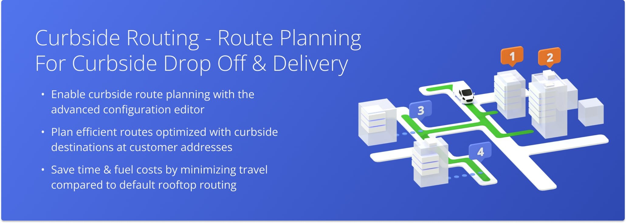
Table of Contents
Rooftop Routing – Plan Routes To The Building’s Exact Location
Rooftop Routing uses the precise GPS coordinates of an address, typically at the center or main entry point of the building. This creates route lines that lead directly to the structure, offering clear visual accuracy.
By default, the system uses Rooftop Routing when you plan routes, placing address pins directly on the building. This improves clarity but also adds some time and distance to the route compared to Curbside Routing with the same customer addresses.
Curbside Routing – Plan Routes To The Nearest Street Entry Point
Curbside Routing, on the other hand, navigates to the closest point on the street accessible by vehicle, usually the curb or driveway entrance. This method prioritizes where a vehicle can safely stop or park, often shortening the overall distance compared to Rooftop Routing.
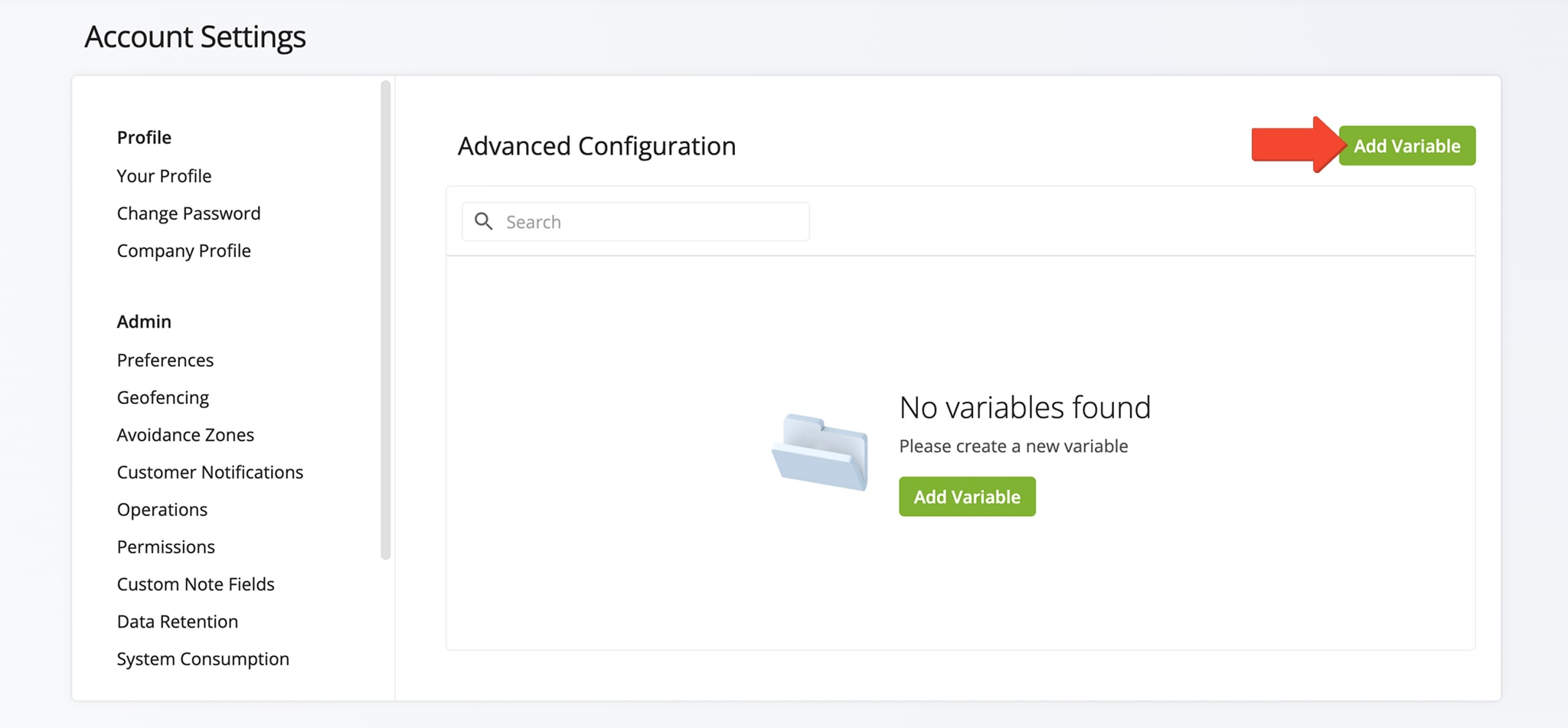
To enable Curbside Routing on your Route4Me account, open your Advanced Configuration Editor and click the “Add Variable” button.
Open Your Advanced Configuration Editor
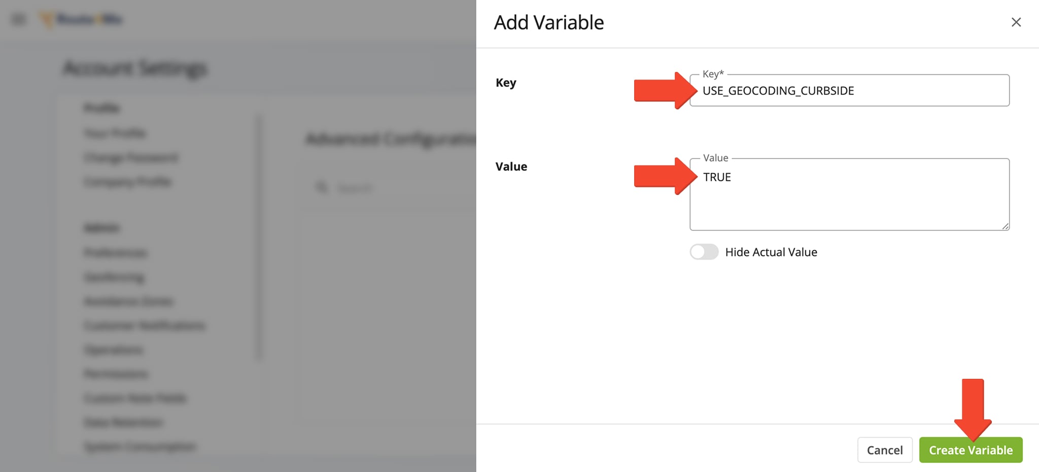
In the “Add Variable” panel, enter the following information in the respective fields:
- Key: “USE_GEOCODING_CURBSIDE“
- Value: “TRUE“, “true” or “1” to enable the Curbside Routing and “FALSE“, “false” or “0” to disable the Curbside Routing
Click “Create Variable” to apply the setting and save it to your list of Advanced Configurations.
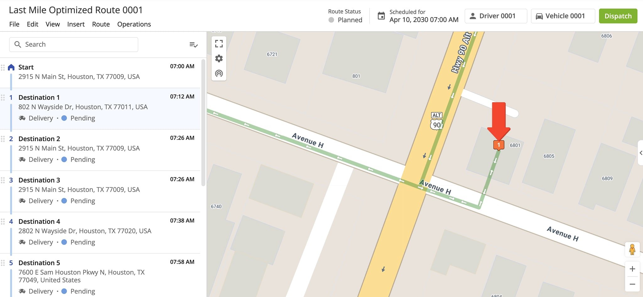
After applying the Curbside Routing variable, you can plan routes as usual. To view Curbside Routing on the map, open a new or existing route from your Routes List.
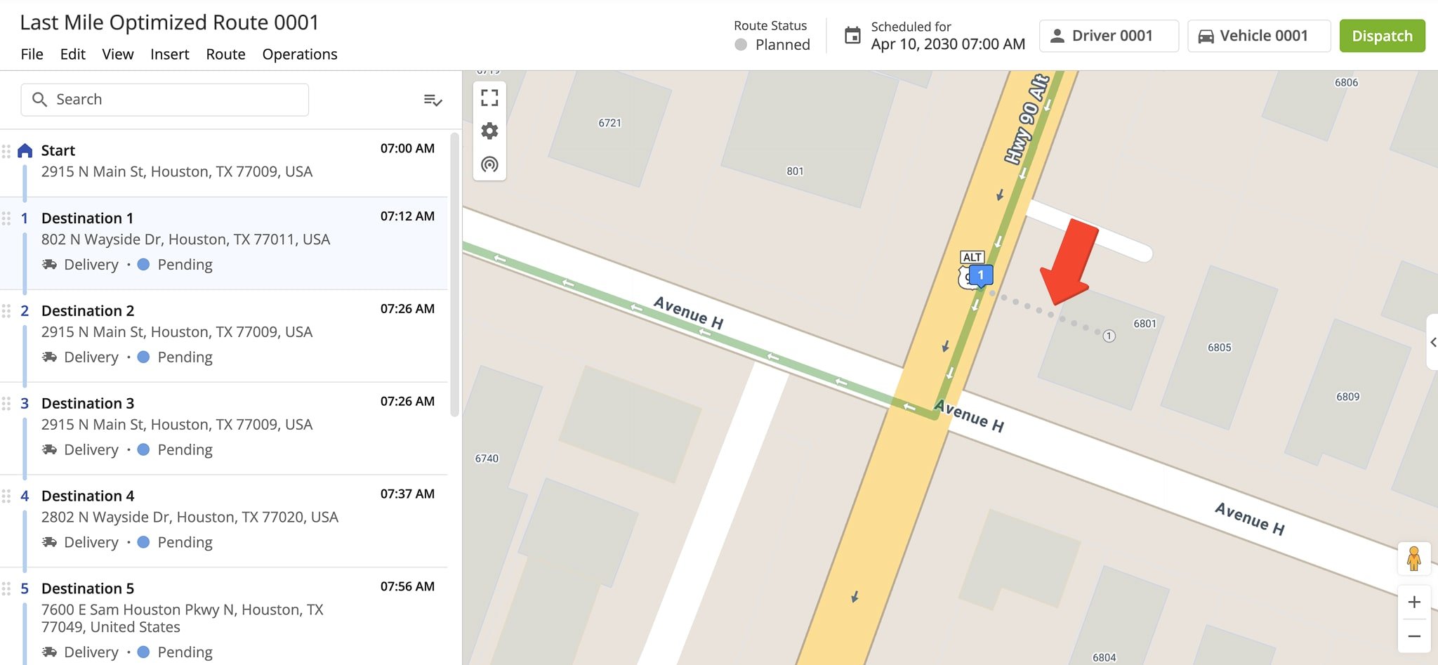
Curbside Routing is displayed as gray dots branching from the main green driving line, leading to the closest accessible point, typically a curb or driveway, before reaching the building.
Visit Route4Me's Marketplace to Check out Associated Modules:
- Routing
Curbside Routing
About author: Alex Yasko
Alex Yasko is the Go-to-Market Product Manager and Information Architecture Manager at Route4Me. With thousands of hours of experience, Alex specializes in breaking down complex last-mile optimization and routing scenarios into simple, actionable instructions, helping last-mile businesses streamline their operations effortlessly.