Geocoding Guide – Address Verification & Location Coordinates Mapping
Standardized addresses are essential for accurate address verification and reliable location mapping. Well-formatted addresses improve geocoding – converting an address into precise latitude and longitude – which leads to more accurate and efficient route planning. This guide explains how to identify, format, and manage standardized addresses in your Route4Me account, including uploading addresses and confirming successful geocoding.
Table of Contents
Standardize Addresses – Geocode Locations With Precision
Geocoding begins with address standardization. Before converting an address into geographic coordinates, it must follow a consistent format set by a local postal service, like the USPS in the United States or La Poste in France. Standards vary by country but, within the US, the format includes the following: Street Address (number and name), City, State, ZIP, and Country.
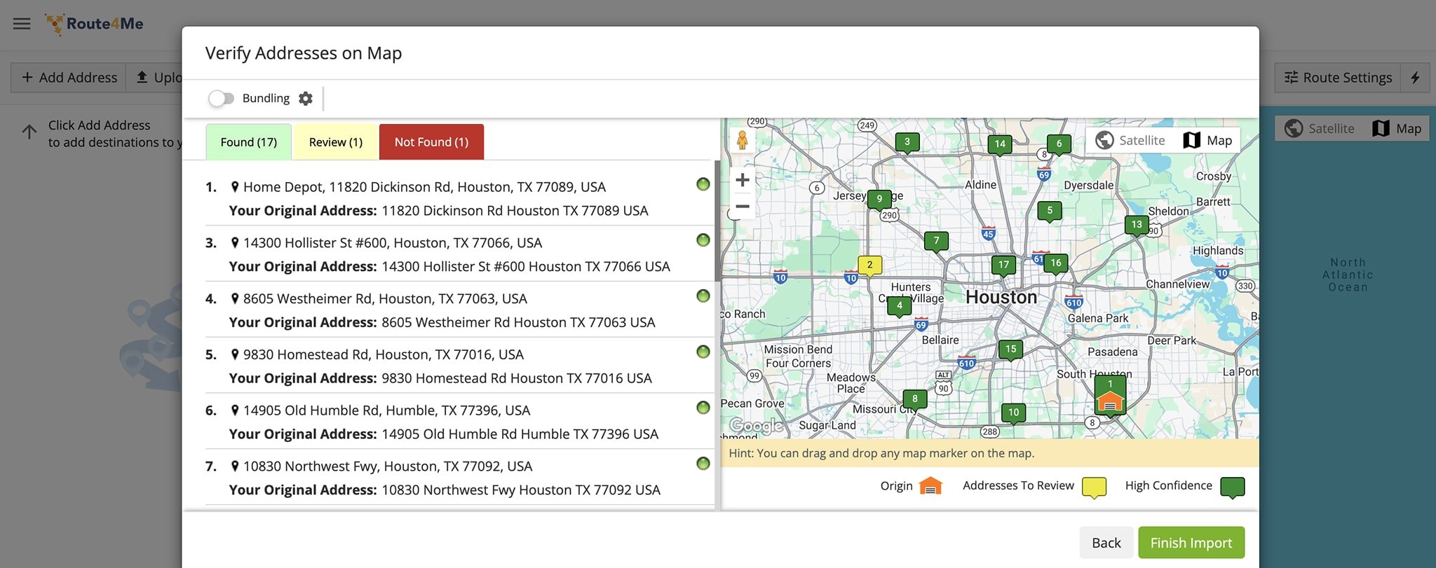
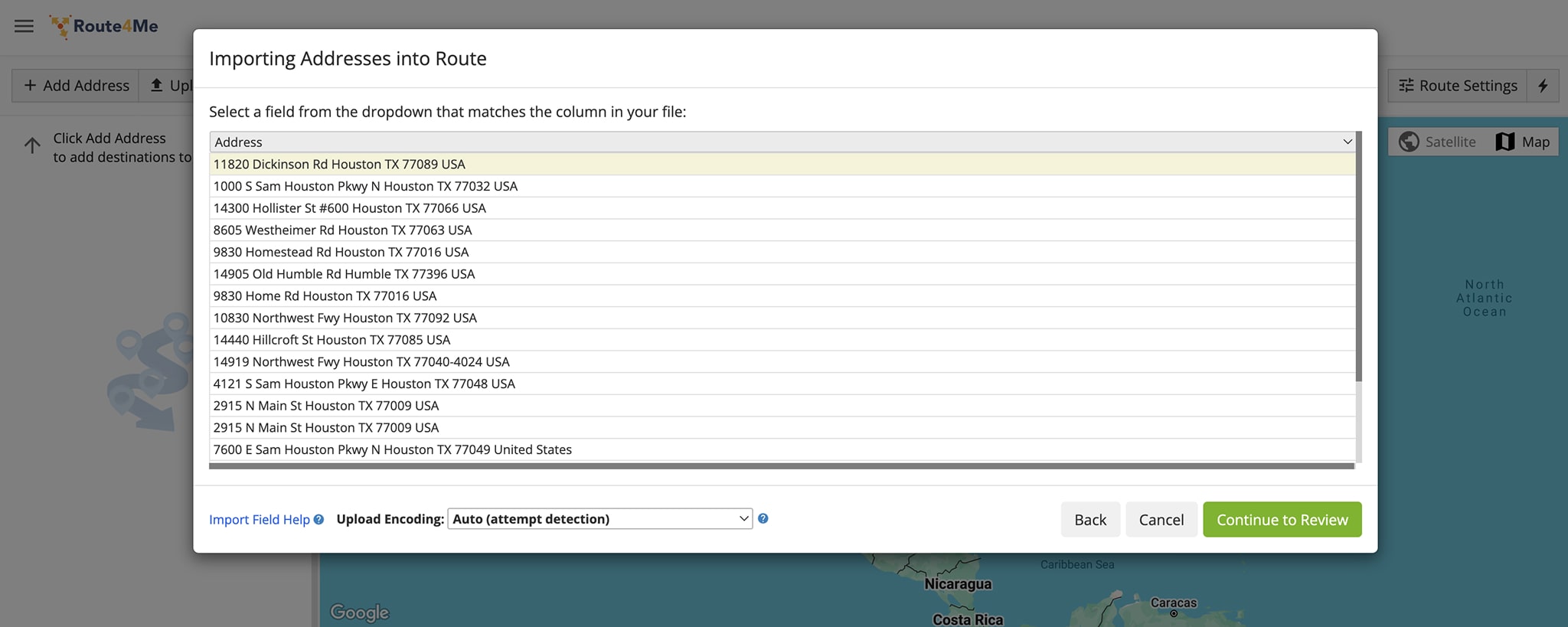
When uploading address spreadsheets, Route4Me automatically attempts to geocode and validate all addresses. They will appear color coded as follows:
- Green: Address geocoded with a high degree of confidence
- Yellow: Unclear address; you should review and edit the address
- Red: Address is unidentifiable; you should replace it with a valid address
Geocode Route Addresses – Verify And Modify Route Locations
Review and verify addresses after importing, manually entering, or adding them to your route. Modify or delete any that need adjustments to ensure accurate routing.
Verify Uploaded Or Imported Addresses
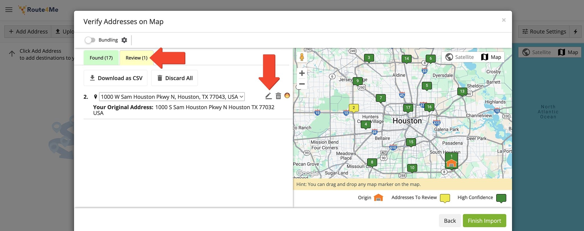
Upon uploading address spreadsheets or importing destination addresses, you can review them on the map. Addresses geocoded with high confidence will appear in green. At the same time, the system will highlight in yellow any addresses it can’t verify with high confidence. You’ll want to review and modify or delete these addresses.
To modify, hover over the address and click the Pencil Icon next to it to make your changes. To delete, click the Delete Icon next to the address. Click the “Finish Import” button to finalize.
Verify Manually Entered Addresses
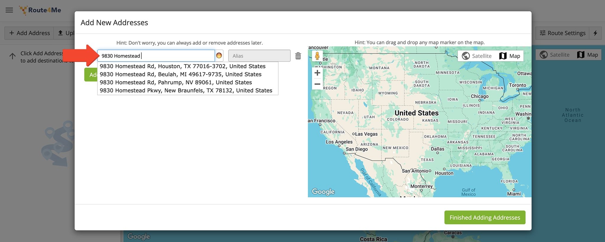
If you prefer to plan a route manually via the Route Planner Interactive Map Editor, you can verify the geographic coordinates of the addresses you enter. Simply type your address into the Address Search Field.
As you enter the address, the system will suggest already geocoded, standardized addresses that resemble your search. To save time, simply click on an address if it matches what you’re looking for.
Verify Addresses Inserted Into Planned Routes
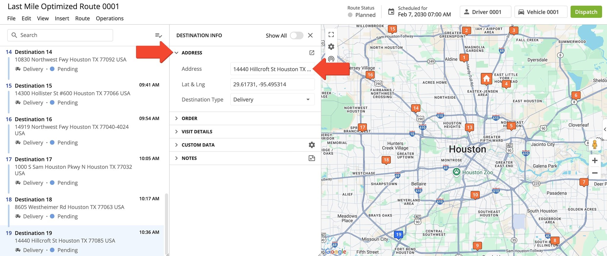
If you would like to insert an address into an already optimized route, you can also verify its geographic coordinates. After adding the address, click the corresponding Destination to view detailed information.
If verified, you should see that it appears as a standardized address along with its latitude and longitude coordinates. If you need to modify the address, you can do so directly in the Address Field.
Geocode Order Addresses – Verify And Modify Order Locations
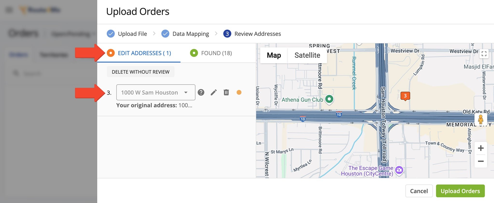
Similarly, you can easily verify addresses when uploading orders into your Orders List. In the Review Addresses screen, you’ll see in the “Found” tab the number of addresses successfully geocoded and validated. In the “Edit Address” tab, you’ll see any specific addresses that need to be reviewed and standardized or deleted.
To modify, you can use the dropdown menu to select a recommended standardized address. Or, to manually edit the address, you can click the Pencil Icon next to it. Alternatively, to delete the address, click the Delete Icon or the “Delete Without Review” button above the address. Click the “Upload Orders” button to finalize.
Geocode Address Book Addresses – Accurately Map Locations
Finally, you can verify addresses when uploading them into your Address Book. Addresses marked as “Found” have been successfully geocoded and verified with a high degree of confidence. Those marked as “Review” need to be reviewed and standardized or deleted.
To modify, hover over the address and click the Pencil Icon next to it. To delete the address, click the Delete Icon. Click the “Finish Import” button to finalize.
Visit Route4Me's Marketplace to Check Out More Add-Ons and Modules:
- Route Optimization
Address Book and Territories Planning
- Operations
Custom Data Add-On
