Switch from Microsoft AutoRoute (Streets & Trips) to Route4Me
Microsoft Streets & Trips (also known as Microsoft AutoRoute) is a discontinued mapping program that no longer provides support for its users. As a Microsoft AutoRoute alternative, we recommend using a more modern route planning solution. What makes Route4Me unique and different from any other route optimization software solutions is that Route4Me can facilitate the needs of virtually any business that requires logistics and enterprise route software. Route4Me offers powerful and user-friendly route planning, route optimization, fleet management, and driver tracking solutions for generating actionable intelligence and optimizing your costs and fleet assets distribution, as well as increasing the overall efficiency of your routing operations.
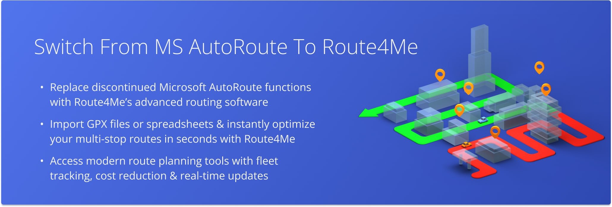
Table of Contents
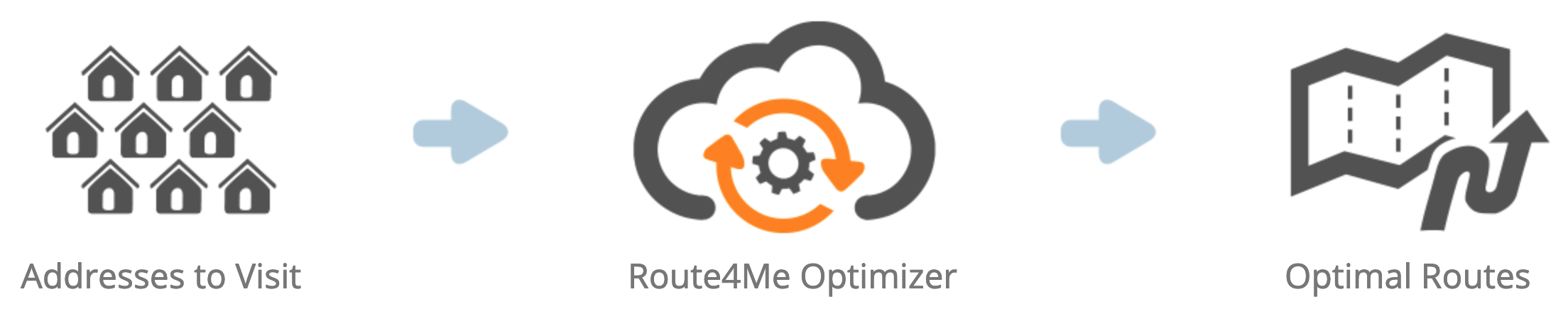
Route4Me Optimization Engine
Route4Me’s enterprise routing api is capable of processing hundreds of thousands of addresses in a fast and smooth manner. All you need to do is input your routing information into the route planning system, and Route4Me will automatically process, correct, geocode, and filter it, outputting ready-to-use data for planning and optimizing efficient and profitable multi stop routes. Route4Me offers multiple types of route optimization that are designed for facilitating the commercial needs of small businesses and large enterprises.
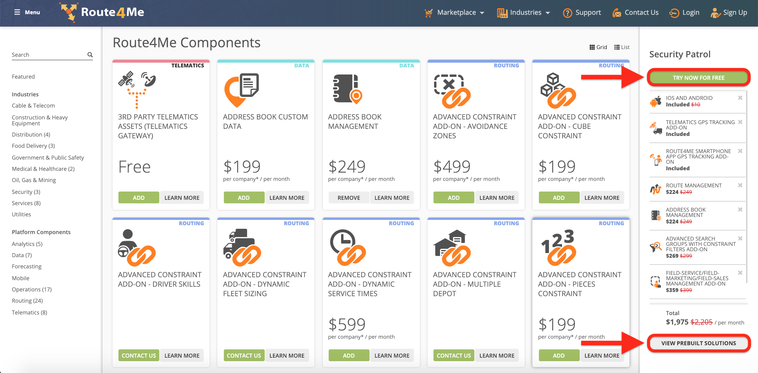
Route4Me Marketplace
Route4Me’s Marketplace enables you to configure your own custom subscription and include only those features and functionalities that accommodate the particular routing needs of your business or business model. For more convenience, you can choose among various industry-specific packages of preselected modules which are focused on solving the unique problems inherent to specific industries. Customizing your subscription plan allows you to gain more control over your operations, as well as eliminate unnecessary and undesired expenses.
Route4Me is the best Microsoft AutoRoute alternative on the market.
How to Switch from Microsoft Streets & Trips to Route4Me
Switching to Route4Me dynamic routing software is fast and easy, all you need to do is download or copy your Microsoft Streets & Trips routing data and import it into your Route4Me account. To do so, first create a new Route4Me account.
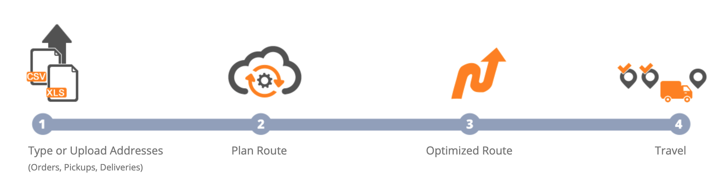
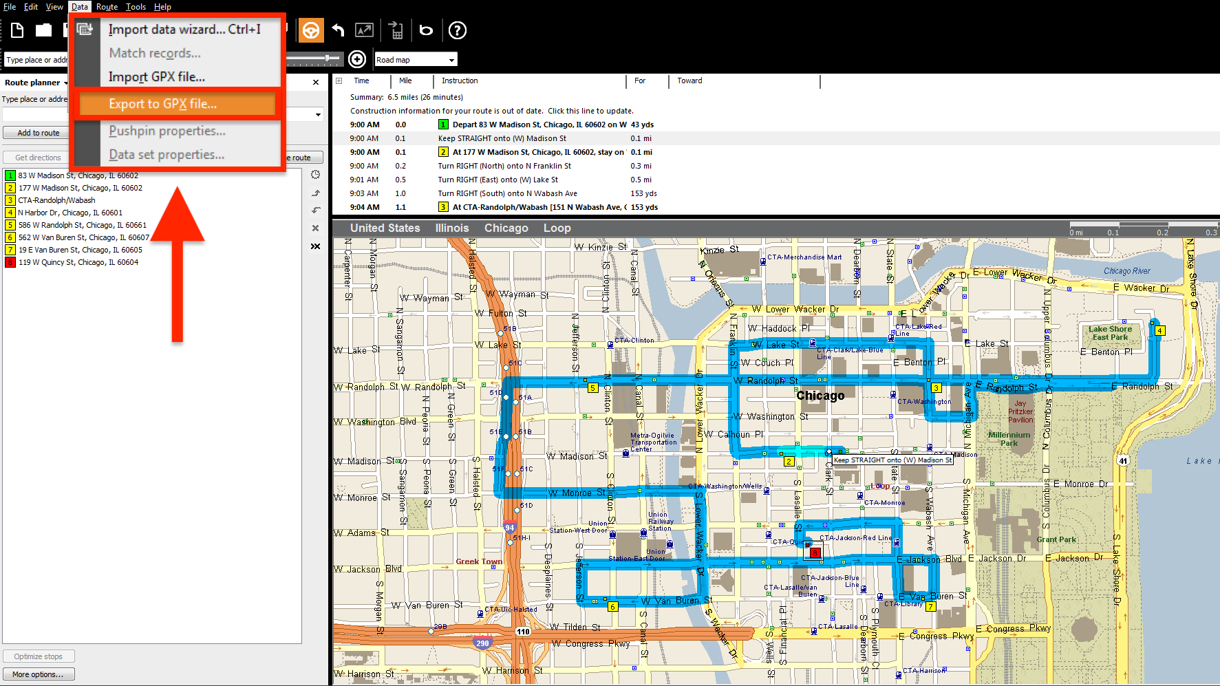
Then, on the Microsoft Streets & Trips main screen, go to Data and then select Export to GPX file. After exporting a GPX file with your routing data, open the corresponding file and then copy addresses or latitude and longitude GPS coordinates from it. After that, format the copied routing data into a spreadsheet and upload it into your Route4Me account.
Formatting Files for Uploading to Route4Me
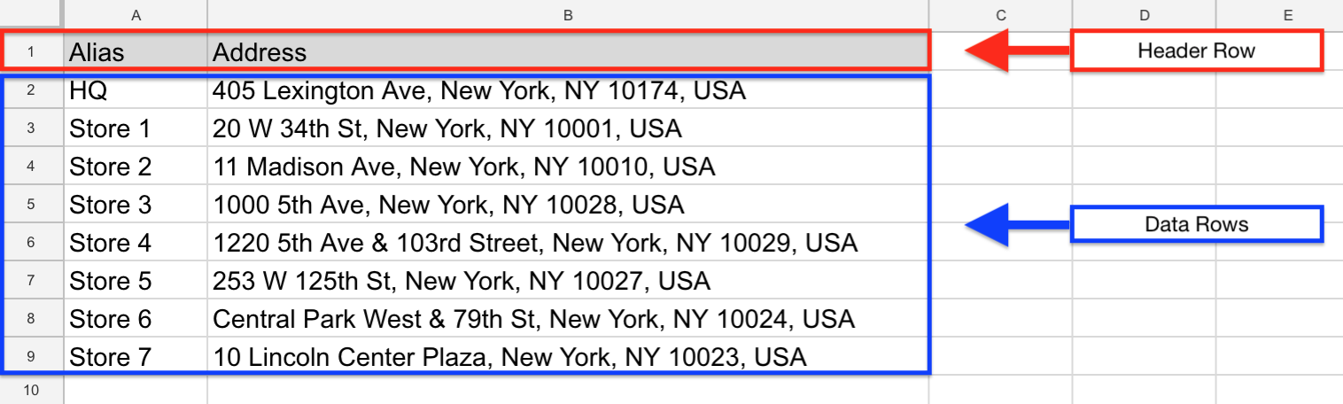
To import routing data into your Route4Me account, first, format it into a spreadsheet. For a spreadsheet to be successfully processed, it should contain a header row and data rows. The header defines the type of information you are importing, while the corresponding data rows contain the actual information you input into the system. The only mandatory column is the Address column which should include the street name and number, city, state, and zip code. Currently, Route4Me supports CSV, XLS, and XLSX upload file formats.
Importing Your Routing Data into Route4Me
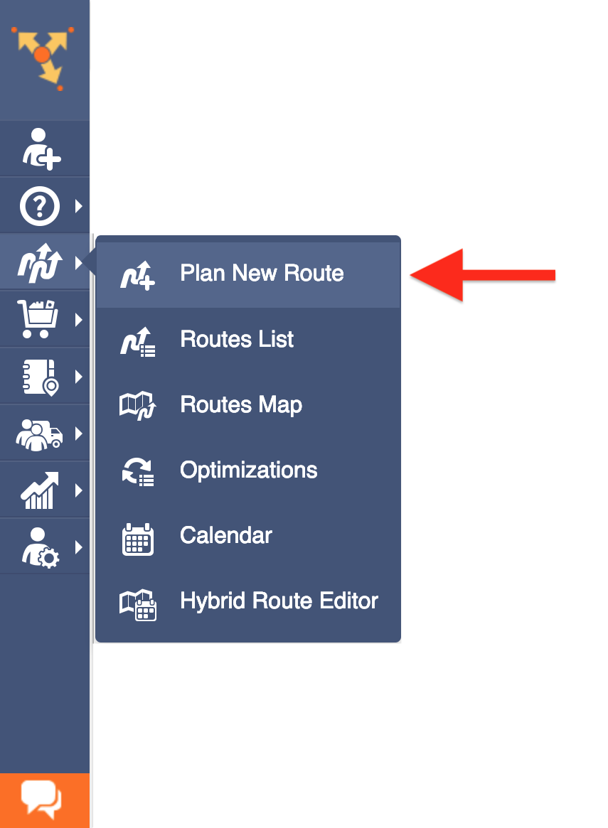
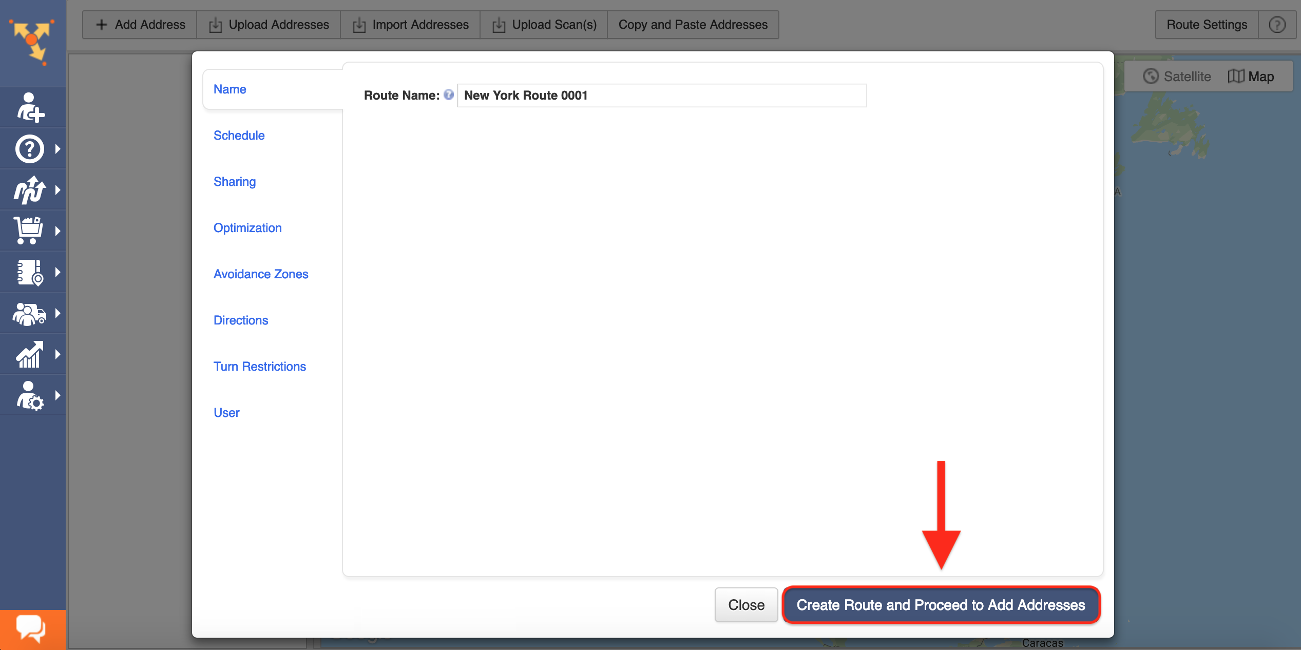
To start planning routes using the downloaded Microsoft Streets & Trips data, first, go to Plan New Route from the navigation menu.
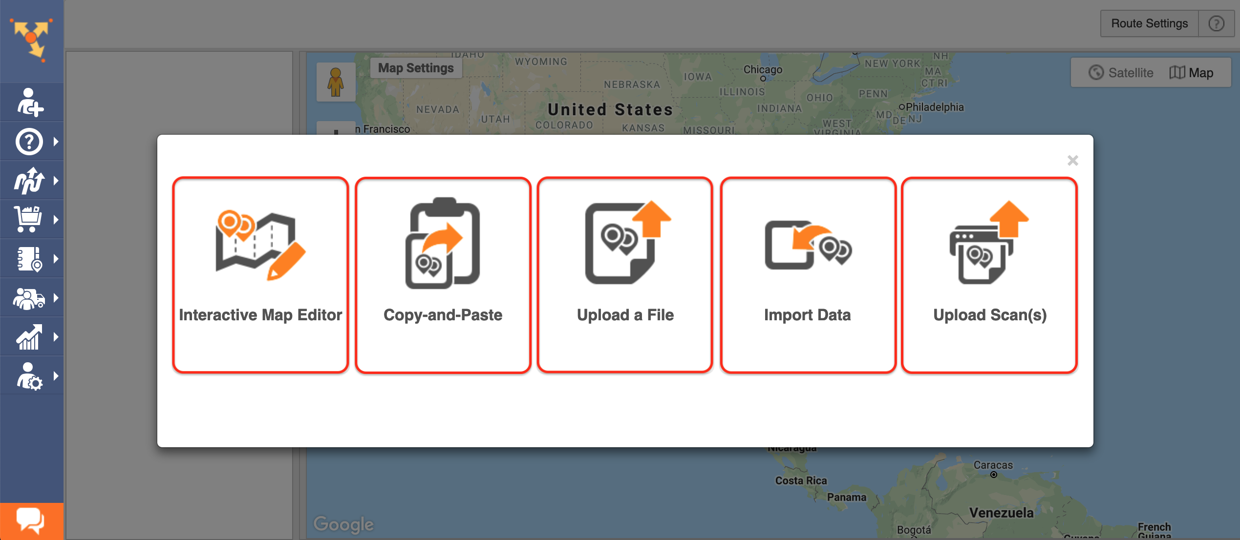
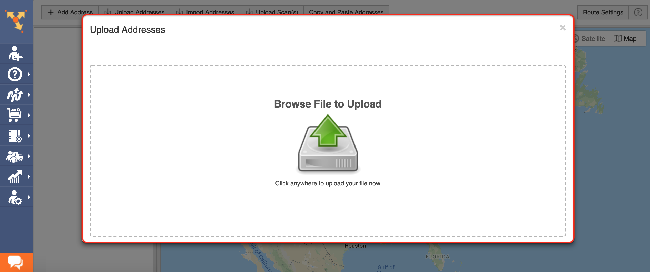
Next, select one of the corresponding import methods. Route4Me offers multiple methods for importing your data into the system. You can upload spreadsheets with thousands of addresses or contacts, and Route4Me will do all the computing and processing for you, delivering corrected and geocoded route destinations. Route4Me allows you to upload scanned documents, import files from various cloud-based storage services, or pick addresses right from the map using Route4Me’s Interactive Map Editor. Select Upload a File to use the formatted spreadsheet.
After that, specify the preferred route parameters and then click on the corresponding button to proceed.
Then, either drag and drop the file/spreadsheet into the corresponding window or click Browse File to Upload and then upload the file from your device. Currently, Route4Me supports CSV, XLS, and XLSX upload file formats. For the most accurate results, it is recommended to use CSV file format spreadsheets.
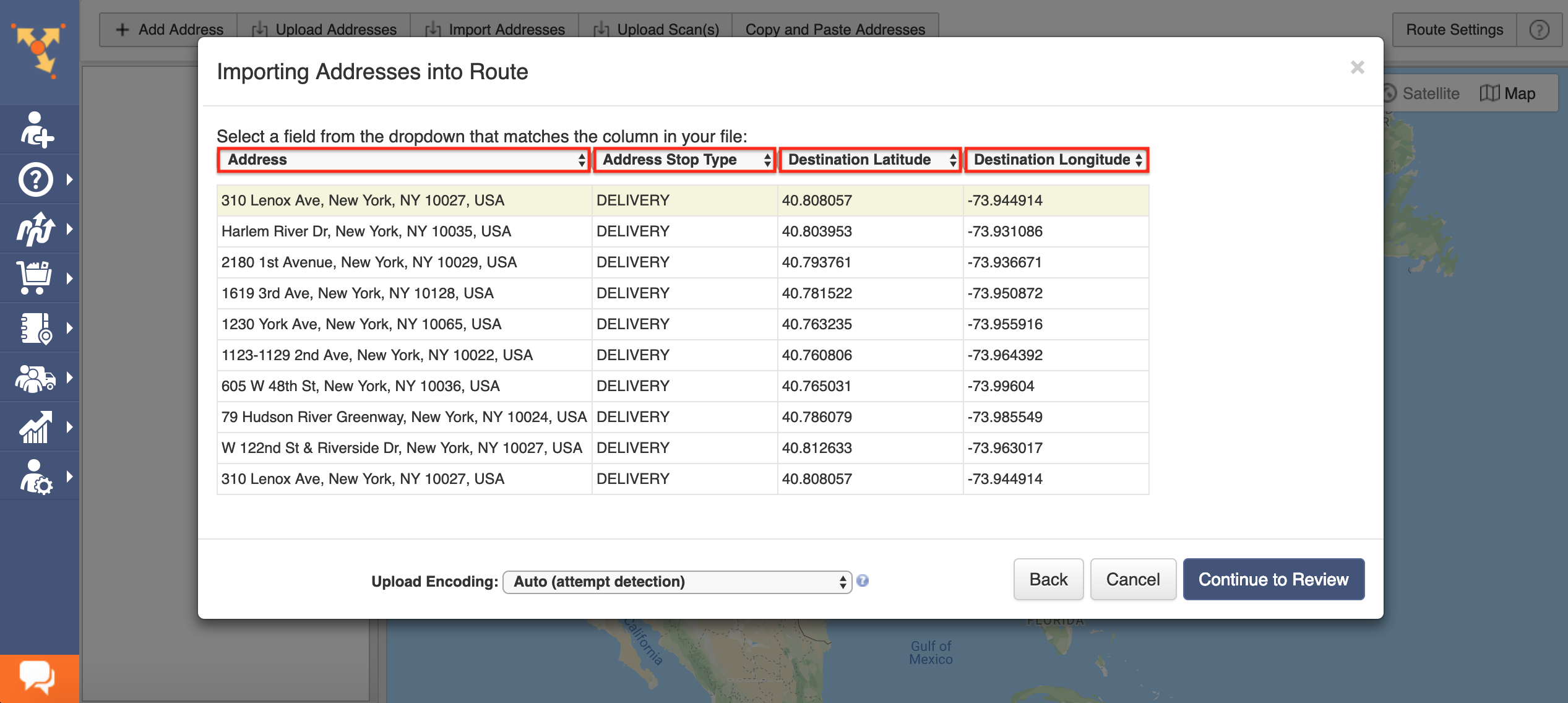
Once you uploaded the spreadsheet, Route4Me processes the imported data and displays it in the corresponding window. For the system to process the data automatically, select the Auto (attempt detection) option respectively.
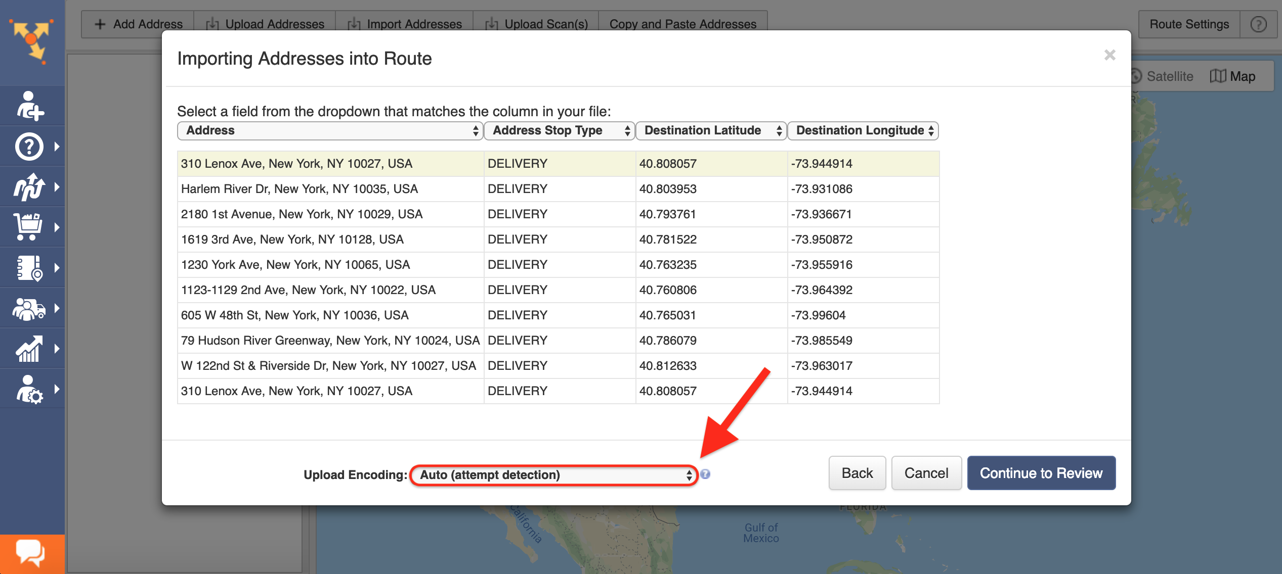
Alternatively, you can manually match column titles to the data contained in the corresponding columns.
Next, click Continue to Review.

In the Verify Addresses on Map window, you can view all imported and processed addresses on the map, as well as check their geocoding statuses. Green-colored dots indicate that the corresponding addresses were successfully geocoded with High Confidence. Addresses that have yellow colored dots next to them should be reviewed and fixed accordingly.
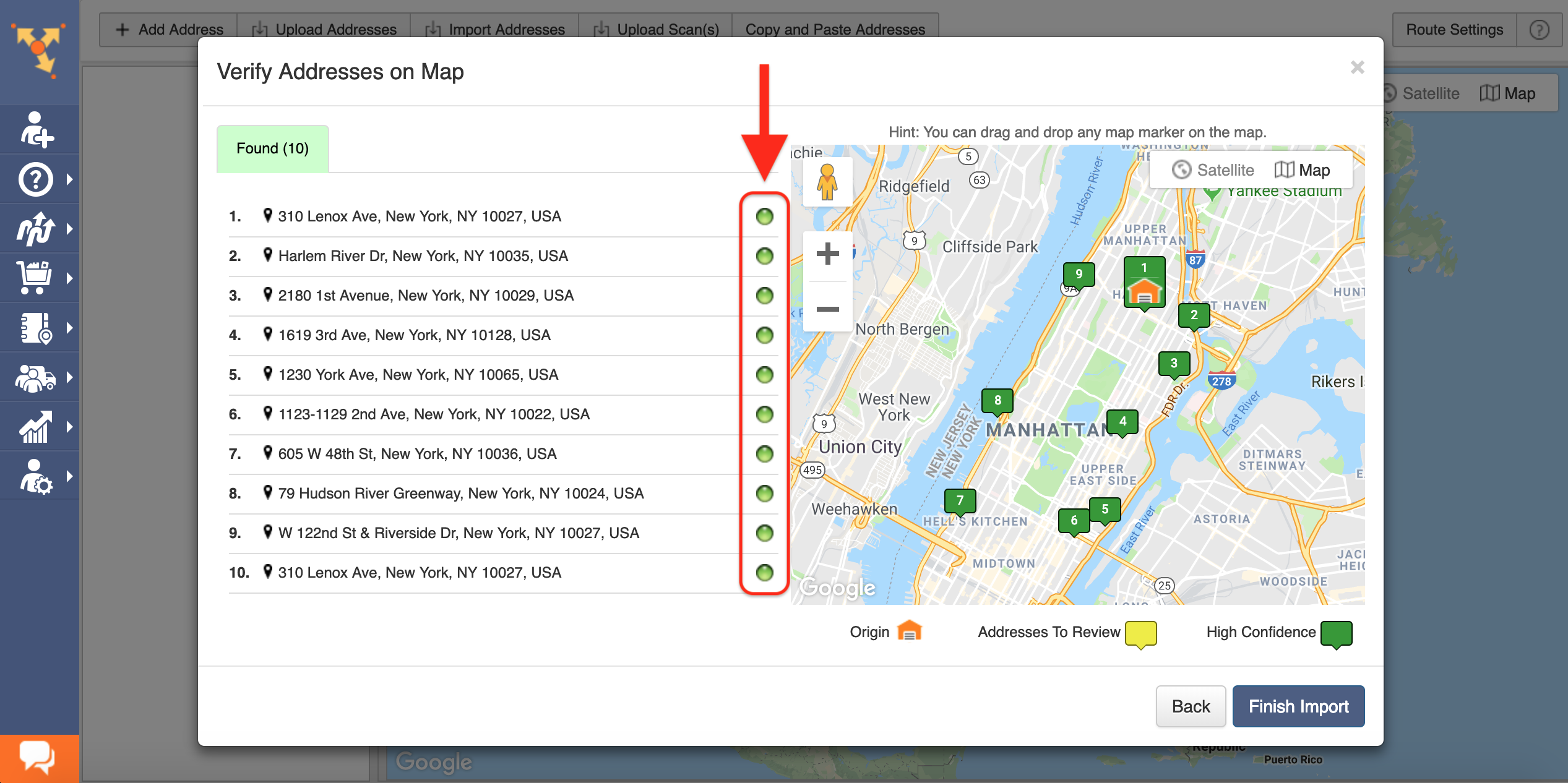
Geocoding is the process of giving/assigning latitude and longitude values/coordinates to street addresses for accurate location detection and precise GPS tracking.
After reviewing the imported addresses, click Finish Import to plan the route.

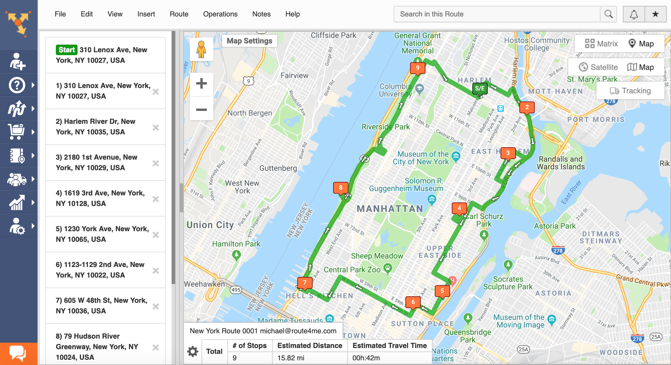
Once the route is planned, it is optimized and then opened in the Route Editor where you can modify it, as well as added to the Routes List with all your routes.
All the trademarks, logos, and brand names on this page are for identification purposes only. We do not endorse these trademarks, logos, and brand names. All the trademarks, logos, and brand names are the property of their respective owners. If any of the trademarks, logos, and brand names are your property or the property of your company, and you would like us to remove them from our website, please contact us at [email protected] to submit your request.
Visit Route4Me's Marketplace to Check Out More Add-Ons and Modules:
- Route Optimization
Address Book and Territories Planning
- Operations
Custom Data Add-On
About author: Alex Yasko
Alex Yasko is the Go-to-Market Product Manager and Information Architecture Manager at Route4Me. With thousands of hours of experience, Alex specializes in breaking down complex last-mile optimization and routing scenarios into simple, actionable instructions, helping last-mile businesses streamline their operations effortlessly.